Tuzha geodata
Tuzha (Kirov) is a populated place; located in Russia in Europe/Kirov (GMT+3) time zone. With population of 5,002 people, there are 2656 cities with bigger population in this country. Compared to other cities in Russia, 80.5% of cities are located further ↓South; 58.7% of cities are located further ←West and 66.6% of cities have higher elevation than Tuzha. Note1


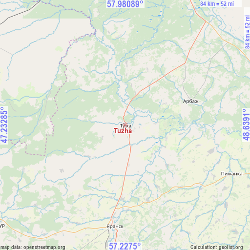
Tuzha GPS coordinates[2]
57° 36' 22.14" North, 47° 56' 9.492" East
| Map corner | latitude | longitude |
|---|---|---|
| Upper-left | 57.98089°, | 47.23285° |
| Center: | 57.60615°, | 47.93597° |
| Lower-right: | 57.2275°, | 48.6391° |
| Map W x H: | 83.8×83.8 km | = 52.1×52.1mi |
| max Lat: | 73.50819° ⇑19.5% North |
| Tuzha: | 57.60615° |
| min Lat: | ⇓80.5% South 41.28413° |
| min Long | Tuzha | max Long |
| -179.12198° | 47.93597° | 179.35046° |
| W 58.7%⇐ | ⇒41.3% E |
Elevation
Elevation of Tuzha is 110 m = 361 ft, and this is 92.6 m = 304 ft below average elevation for this country.
| Max E: |
2518 m = 8261 ft | 66.6% |
| Avg. | 202.6 m = 665 ft | |
| Tuzha | 110 m = 361 ft | |
Min E: |
-28 m = -92 ft | 33.4% |
See also: Russia elevation on elevation.city.
Geographical zone
Tuzha is located in North temperate zone (between Tropic of Cancer and the Arctic Circle). Distance of this North polar circle is 996 km =618.9 mi to North.| Distance of | km | miles | from Tuzha |
|---|---|---|---|
| North Pole | 3601.9 | 2238.1 | to North |
| Arctic Circle | 996 | 618.9 | to North |
| Tropic Cancer | 3799.3 | 2360.8 | to South |
| Equator | 6405.2 | 3980 | to South |


Nearby cities:
15 places around Tuzha: (largest is in red/bold)
• Arbazh
23.5 km =14.6 mi,  69°
69°
• Kiknur
55.4 km =34.4 mi,  232°
232°
• Kotel’nich
81.8 km =50.8 mi,  17°
17°
• Orshanka
76.8 km =47.7 mi,  181°
181°
• Pizhanka
39.6 km =24.6 mi,  114°
114°
• Pizhma
56.4 km =35 mi,  300°
300°
• Sanchursk
84.7 km =52.6 mi,  209°
209°
• Shakhun’ya
79.2 km =49.2 mi,  275°
275°
• Shaygino
66.3 km =41.2 mi,  285°
285°
• Sovetsk
61 km =37.9 mi,  92°
92°
• Svecha
78.8 km =49 mi,  341°
341°
• Tonshayevo
56.8 km =35.3 mi, 284°
• Vakhtan
84 km =52.2 mi, 298°
• Verkhoshizhem’ye
82.5 km =51.3 mi,  56°
56°
• Yaransk
33.8 km =21 mi,  185°
185°
Sources, notices
• [Note1] Compared only with cities in Russia existing in our database
• [Src1] Map data: © OpenStreetMap contributors (CC-BY-SA)
• [Src2] Other city data from geonames.org with taken over terms of usage.
• [Src3] Geographical zone / Annual Mean Temperature by Robert A. Rohde @ Wikipedia
