Sechenovo geodata
Sechenovo (Nizhny Novgorod Oblast) is a populated place; located in Russia in Europe/Moscow (GMT+3) time zone. With population of 5,151 people, there are 2576 cities with bigger population in this country. Compared to other cities in Russia, 55.5% of cities are located further ↓South; 52.5% of cities are located further ←West and 60.9% of cities have lower elevation than Sechenovo. Note1


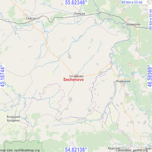
Sechenovo GPS coordinates[2]
55° 13' 27.984" North, 45° 53' 26.016" East
| Map corner | latitude | longitude |
|---|---|---|
| Upper-left | 55.62346°, | 45.18744° |
| Center: | 55.22444°, | 45.89056° |
| Lower-right: | 54.82138°, | 46.59369° |
| Map W x H: | 89.2×89.2 km | = 55.4×55.4mi |
| max Lat: | 73.50819° ⇑44.5% North |
| Sechenovo: | 55.22444° |
| min Lat: | ⇓55.5% South 41.28413° |
| min Long | Sechenovo | max Long |
| -179.12198° | 45.89056° | 179.35046° |
| W 52.5%⇐ | ⇒47.5% E |
Elevation
Elevation of Sechenovo is 171 m = 561 ft, and this is 31.6 m = 104 ft below average elevation for this country.
| Max E: |
2518 m = 8261 ft | 39.1% |
| Avg. | 202.6 m = 665 ft | |
| Sechenovo | 171 m = 561 ft | |
Min E: |
-28 m = -92 ft | 60.9% |
See also: Russia elevation on elevation.city.
Geographical zone
Sechenovo is located in North temperate zone (between Tropic of Cancer and the Arctic Circle). Distance of this North polar circle is 1260.8 km =783.4 mi to North.| Distance of | km | miles | from Sechenovo |
|---|---|---|---|
| North Pole | 3866.7 | 2402.7 | to North |
| Arctic Circle | 1260.8 | 783.4 | to North |
| Tropic Cancer | 3534.5 | 2196.2 | to South |
| Equator | 6140.4 | 3815.5 | to South |


Nearby cities:
15 places around Sechenovo: (largest is in red/bold)
• Alatyr’
61.2 km =38 mi,  134°
134°
• Ardatov
47.4 km =29.5 mi,  152°
152°
• Bol’shoye Boldino
44 km =27.3 mi,  236°
236°
• Gagino
54.3 km =33.7 mi,  270°
270°
• Kemlya
71.8 km =44.6 mi,  215°
215°
• Kirya
63.7 km =39.6 mi,  104°
104°
• Krasnaya Gorka
22.7 km =14.1 mi,  37°
37°
• Krasnyye Chetai
53.9 km =33.5 mi,  16°
16°
• Pil’na
36.7 km =22.8 mi,  3°
3°
• Poretskoye
28 km =17.4 mi, 96°
• Sergach
43.4 km =27 mi,  321°
321°
• Shumerlya
45.1 km =28 mi,  47°
47°
• Spasskoye
71.8 km =44.6 mi,  350°
350°
• Turgenevo
50.6 km =31.4 mi, 146°
• Urazovka
26.1 km =16.2 mi, 318°
Sources, notices
• [Note1] Compared only with cities in Russia existing in our database
• [Src1] Map data: © OpenStreetMap contributors (CC-BY-SA)
• [Src2] Other city data from geonames.org with taken over terms of usage.
• [Src3] Geographical zone / Annual Mean Temperature by Robert A. Rohde @ Wikipedia
