Tot’ma geodata
Tot’ma (Vologda) is a populated place; located in Russia in Europe/Moscow (GMT+3) time zone. With population of 10,500 people, there are 1442 cities with bigger population in this country. Compared to other cities in Russia, 90% of cities are located further ↓South; 57.6% of cities are located further →East and 58.6% of cities have higher elevation than Tot’ma. Note1


Tot’ma GPS coordinates[2]
59° 58' 25.5" North, 42° 45' 53.532" East
| Map corner | latitude | longitude |
|---|---|---|
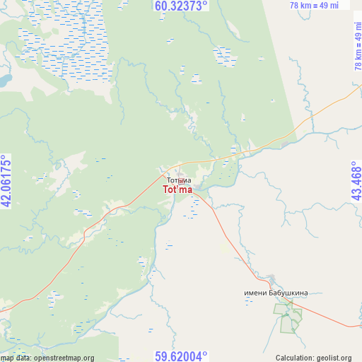
| Upper-left | 60.32373°, | 42.06175° |
| Center: | 59.97375°, | 42.76487° |
| Lower-right: | 59.62004°, | 43.468° |
| Map W x H: | 78.2×78.2 km | = 48.6×48.6mi |
| max Lat: | 73.50819° ⇑10% North |
| Tot’ma: | 59.97375° |
| min Lat: | ⇓90% South 41.28413° |
| min Long | Tot’ma | max Long |
| -179.12198° | 42.76487° | 179.35046° |
| W 42.4%⇐ | ⇒57.6% E |
Elevation
Elevation of Tot’ma is 127 m = 417 ft, and this is 75.6 m = 248 ft below average elevation for this country.
| Max E: |
2518 m = 8261 ft | 58.6% |
| Avg. | 202.6 m = 665 ft | |
| Tot’ma | 127 m = 417 ft | |
Min E: |
-28 m = -92 ft | 41.4% |
See also: Russia elevation on elevation.city.
Geographical zone
Tot’ma is located in North temperate zone (between Tropic of Cancer and the Arctic Circle). Distance of this North polar circle is 732.7 km =455.3 mi to North.| Distance of | km | miles | from Tot’ma |
|---|---|---|---|
| North Pole | 3338.6 | 2074.5 | to North |
| Arctic Circle | 732.7 | 455.3 | to North |
| Tropic Cancer | 4062.5 | 2524.3 | to South |
| Equator | 6668.5 | 4143.6 | to South |


Nearby cities:
15 places around Tot’ma: (largest is in red/bold)
• Chukhloma
135.7 km =84.3 mi,  181°
181°
• Ileza
135.2 km =84 mi,  27°
27°
• Imeni Babushkina
31.5 km =19.6 mi,  139°
139°
• Kadnikov
145.7 km =90.5 mi,  248°
248°
• Kharovsk
143.2 km =89 mi,  269°
269°
• Kuloy
118.4 km =73.6 mi,  352°
352°
• Nyuksenitsa
94.6 km =58.8 mi,  59°
59°
• Shangaly
132.1 km =82.1 mi,  13°
13°
• Shuyskoye
118 km =73.3 mi,  235°
235°
• Solginskiy
142.7 km =88.7 mi,  326°
326°
• Soligalich
103 km =64 mi,  195°
195°
• Syamzha
94.8 km =58.9 mi, 272°
• Tarnogskiy Gorodok
73.7 km =45.8 mi,  37°
37°
• Vel’sk
127.2 km =79 mi,  343°
343°
• Verkhovazh’ye
94.6 km =58.8 mi, 335°
Sources, notices
• [Note1] Compared only with cities in Russia existing in our database
• [Src1] Map data: © OpenStreetMap contributors (CC-BY-SA)
• [Src2] Other city data from geonames.org with taken over terms of usage.
• [Src3] Geographical zone / Annual Mean Temperature by Robert A. Rohde @ Wikipedia
