Tarnogskiy Gorodok geodata
Tarnogskiy Gorodok (Vologda) is a populated place; located in Russia in Europe/Moscow (GMT+3) time zone. With population of 5,432 people, there are 2463 cities with bigger population in this country. Compared to other cities in Russia, 92.1% of cities are located further ↓South; 54.4% of cities are located further →East and 70.6% of cities have higher elevation than Tarnogskiy Gorodok. Note1


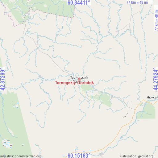
Tarnogskiy Gorodok GPS coordinates[2]
60° 29' 58.992" North, 43° 34' 33.996" East
| Map corner | latitude | longitude |
|---|---|---|
| Upper-left | 60.84411°, | 42.87299° |
| Center: | 60.49972°, | 43.57611° |
| Lower-right: | 60.15163°, | 44.27924° |
| Map W x H: | 77×77 km | = 47.8×47.8mi |
| max Lat: | 73.50819° ⇑7.9% North |
| Tarnogskiy Gorodok: | 60.49972° |
| min Lat: | ⇓92.1% South 41.28413° |
| min Long | Tarnogskiy Goro | max Long |
| -179.12198° | 43.57611° | 179.35046° |
| W 45.6%⇐ | ⇒54.4% E |
Elevation
Elevation of Tarnogskiy Gorodok is 101 m = 331 ft, and this is 101.6 m = 333 ft below average elevation for this country.
| Max E: |
2518 m = 8261 ft | 70.6% |
| Avg. | 202.6 m = 665 ft | |
| Tarnogskiy Gorodok | 101 m = 331 ft | |
Min E: |
-28 m = -92 ft | 29.4% |
See also: Russia elevation on elevation.city.
Geographical zone
Tarnogskiy Gorodok is located in North temperate zone (between Tropic of Cancer and the Arctic Circle). Distance of this North polar circle is 674.2 km =418.9 mi to North.| Distance of | km | miles | from Tarnogskiy Gorodok |
|---|---|---|---|
| North Pole | 3280.1 | 2038.2 | to North |
| Arctic Circle | 674.2 | 418.9 | to North |
| Tropic Cancer | 4121 | 2560.7 | to South |
| Equator | 6726.9 | 4179.9 | to South |


Nearby cities:
15 places around Tarnogskiy Gorodok: (largest is in red/bold)
• Berëznik
81.9 km =50.9 mi,  1°
1°
• Ileza
64 km =39.8 mi,  15°
15°
• Imeni Babushkina
86.2 km =53.6 mi,  196°
196°
• Kichmengskiy Gorodok
134.8 km =83.8 mi,  115°
115°
• Kizema
96.3 km =59.8 mi,  44°
44°
• Kuloy
83.3 km =51.8 mi,  315°
315°
• Loyga
85.3 km =53 mi, 41°
• Mirnyy
106.2 km =66 mi,  29°
29°
• Nyuksenitsa
37.3 km =23.2 mi,  105°
105°
• Shangaly
71.1 km =44.2 mi,  349°
349°
• Solginskiy
135.8 km =84.4 mi,  296°
296°
• Tot’ma
73.7 km =45.8 mi,  217°
217°
• Ust’-Shonosha
141.2 km =87.7 mi, 300°
• Vel’sk
102.2 km =63.5 mi,  308°
308°
• Verkhovazh’ye
87.8 km =54.6 mi,  288°
288°
Sources, notices
• [Note1] Compared only with cities in Russia existing in our database
• [Src1] Map data: © OpenStreetMap contributors (CC-BY-SA)
• [Src2] Other city data from geonames.org with taken over terms of usage.
• [Src3] Geographical zone / Annual Mean Temperature by Robert A. Rohde @ Wikipedia
