Terekli-Mekteb geodata
Terekli-Mekteb (Dagestan) is a populated place; located in Russia in Europe/Moscow (GMT+3) time zone. With population of 7,799 people, there are 1854 cities with bigger population in this country. Compared to other cities in Russia, 91% of cities are located further ↑North; 52.4% of cities are located further ←West and 92.5% of cities have higher elevation than Terekli-Mekteb. Note1


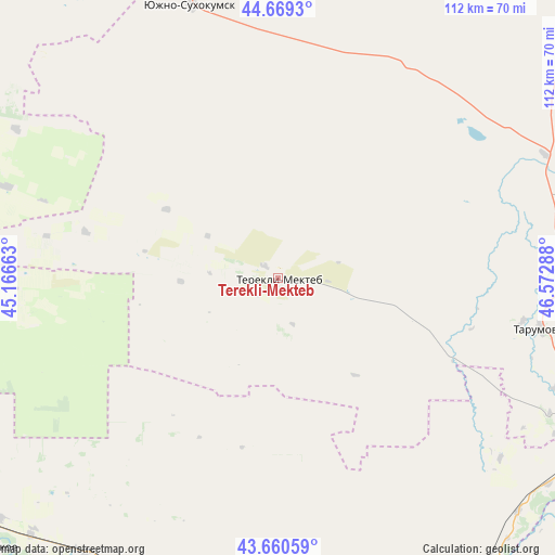
Terekli-Mekteb GPS coordinates[2]
44° 10' 1.56" North, 45° 52' 11.1" East
| Map corner | latitude | longitude |
|---|---|---|
| Upper-left | 44.6693°, | 45.16663° |
| Center: | 44.1671°, | 45.86975° |
| Lower-right: | 43.66059°, | 46.57288° |
| Map W x H: | 112.2×112.2 km | = 69.7×69.7mi |
| max Lat: | 73.50819° ⇑91% North |
| Terekli-Mekteb: | 44.1671° |
| min Lat: | ⇓9% South 41.28413° |
| min Long | Terekli-Mekteb | max Long |
| -179.12198° | 45.86975° | 179.35046° |
| W 52.4%⇐ | ⇒47.6% E |
Elevation
Elevation of Terekli-Mekteb is 20 m = 66 ft, and this is 182.6 m = 599 ft below average elevation for this country.
| Max E: |
2518 m = 8261 ft | 92.5% |
| Avg. | 202.6 m = 665 ft | |
| Terekli-Mekteb | 20 m = 66 ft | |
Min E: |
-28 m = -92 ft | 7.5% |
See also: Russia elevation on elevation.city.
Geographical zone
Terekli-Mekteb is located in North temperate zone (between Tropic of Cancer and the Arctic Circle). Distance of this Northern Tropic circle is 2305 km =1432.3 mi to South.| Distance of | km | miles | from Terekli-Mekteb |
|---|---|---|---|
| North Pole | 5096.1 | 3166.6 | to North |
| Arctic Circle | 2490.3 | 1547.4 | to North |
| Tropic Cancer | 2305 | 1432.3 | to South |
| Equator | 4910.9 | 3051.5 | to South |


Nearby cities:
15 places around Terekli-Mekteb: (largest is in red/bold)
• Alpatovo
72.1 km =44.8 mi,  224°
224°
• Ishcherskaya
77.6 km =48.2 mi,  229°
229°
• Kalinovskaya
71.6 km =44.5 mi,  202°
202°
• Kara-Tyube
62.2 km =38.6 mi,  326°
326°
• Kargalinskaya
67.7 km =42.1 mi,  134°
134°
• Kayasula
71.5 km =44.4 mi,  284°
284°
• Kizlyar
76.3 km =47.4 mi,  117°
117°
• Kochubey
61.7 km =38.3 mi,  66°
66°
• Komsomol’skiy
69.5 km =43.2 mi,  107°
107°
• Lakha Nëvre
73.9 km =45.9 mi, 215°
• Lakkha Nëvre
79.6 km =49.5 mi, 218°
• Naurskaya
72.8 km =45.2 mi, 217°
• Pervomayskoye
72.6 km =45.1 mi, 112°
• Tarumovka
54.1 km =33.6 mi,  100°
100°
• Yuzhno-Sukhokumsk
57.5 km =35.7 mi,  341°
341°
Sources, notices
• [Note1] Compared only with cities in Russia existing in our database
• [Src1] Map data: © OpenStreetMap contributors (CC-BY-SA)
• [Src2] Other city data from geonames.org with taken over terms of usage.
• [Src3] Geographical zone / Annual Mean Temperature by Robert A. Rohde @ Wikipedia
