Kayasula geodata
Kayasula (Stavropol’ Kray) is a populated place; located in Russia in Europe/Moscow (GMT+3) time zone. With population of 4,982 people, there are 2674 cities with bigger population in this country. Compared to other cities in Russia, 90.1% of cities are located further ↑North; 50% of cities are located further ←West and 76.1% of cities have higher elevation than Kayasula. Note1


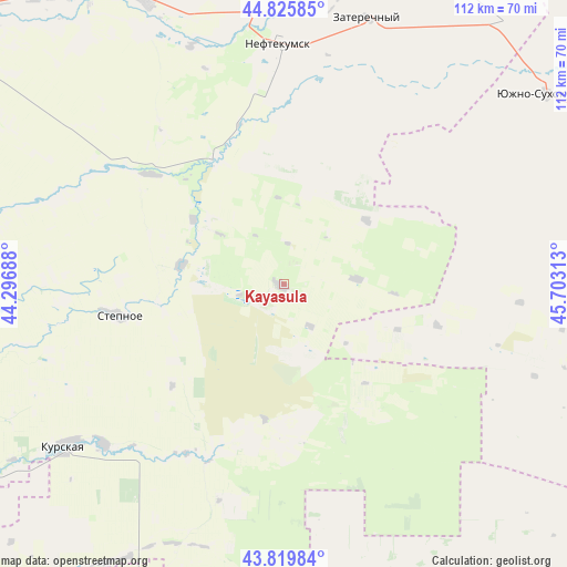
Kayasula GPS coordinates[2]
44° 19' 30" North, 45° 0' 0" East
| Map corner | latitude | longitude |
|---|---|---|
| Upper-left | 44.82585°, | 44.29688° |
| Center: | 44.325°, | 45° |
| Lower-right: | 43.81984°, | 45.70313° |
| Map W x H: | 111.9×111.9 km | = 69.5×69.5mi |
| max Lat: | 73.50819° ⇑90.1% North |
| Kayasula: | 44.325° |
| min Lat: | ⇓9.9% South 41.28413° |
| min Long | Kayasula | max Long |
| -179.12198° | 45° | 179.35046° |
| W 50%⇐ | ⇒50% E |
Elevation
Elevation of Kayasula is 84 m = 276 ft, and this is 118.6 m = 389 ft below average elevation for this country.
| Max E: |
2518 m = 8261 ft | 76.1% |
| Avg. | 202.6 m = 665 ft | |
| Kayasula | 84 m = 276 ft | |
Min E: |
-28 m = -92 ft | 23.9% |
See also: Russia elevation on elevation.city.
Geographical zone
Kayasula is located in North temperate zone (between Tropic of Cancer and the Arctic Circle). Distance of this Northern Tropic circle is 2322.6 km =1443.2 mi to South.| Distance of | km | miles | from Kayasula |
|---|---|---|---|
| North Pole | 5078.6 | 3155.7 | to North |
| Arctic Circle | 2472.7 | 1536.5 | to North |
| Tropic Cancer | 2322.6 | 1443.2 | to South |
| Equator | 4928.5 | 3062.4 | to South |


Nearby cities:
15 places around Kayasula: (largest is in red/bold)
• Achikulak
28.3 km =17.6 mi,  332°
332°
• Edissiya
47.6 km =29.6 mi,  230°
230°
• Irgakly
19.8 km =12.3 mi,  281°
281°
• Kara-Tyube
48.8 km =30.3 mi,  45°
45°
• Kurskaya
53.5 km =33.2 mi,  235°
235°
• Levokumskoye
61.4 km =38.2 mi, 334°
• Nadezhda
40.5 km =25.2 mi, 231°
• Neftekumsk
47.9 km =29.8 mi,  359°
359°
• Pravokumskoye
56.8 km =35.3 mi, 330°
• Solomenskoye
52.9 km =32.9 mi,  256°
256°
• Stepnoye
33.6 km =20.9 mi, 259°
• Urozhaynoye
51.9 km =32.2 mi,  353°
353°
• Vostochny
63.9 km =39.7 mi,  268°
268°
• Yuzhno-Sukhokumsk
63.1 km =39.2 mi, 54°
• Zaterechnyy
54.6 km =33.9 mi,  17°
17°
Sources, notices
• [Note1] Compared only with cities in Russia existing in our database
• [Src1] Map data: © OpenStreetMap contributors (CC-BY-SA)
• [Src2] Other city data from geonames.org with taken over terms of usage.
• [Src3] Geographical zone / Annual Mean Temperature by Robert A. Rohde @ Wikipedia
