Kara-Tyube geodata
Kara-Tyube (Stavropol’ Kray) is a populated place; located in Russia in Europe/Moscow (GMT+3) time zone. With population of 3,359 people, there are 3494 cities with bigger population in this country. Compared to other cities in Russia, 89% of cities are located further ↑North; 51.3% of cities are located further ←West and 91.1% of cities have higher elevation than Kara-Tyube. Note1


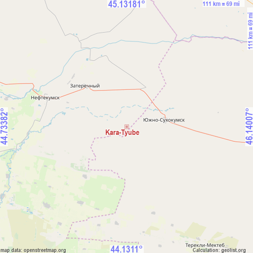
Kara-Tyube GPS coordinates[2]
44° 38' 0.996" North, 45° 26' 12.984" East
| Map corner | latitude | longitude |
|---|---|---|
| Upper-left | 45.13181°, | 44.73382° |
| Center: | 44.63361°, | 45.43694° |
| Lower-right: | 44.1311°, | 46.14007° |
| Map W x H: | 111.3×111.3 km | = 69.2×69.2mi |
| max Lat: | 73.50819° ⇑89% North |
| Kara-Tyube: | 44.63361° |
| min Lat: | ⇓11% South 41.28413° |
| min Long | Kara-Tyube | max Long |
| -179.12198° | 45.43694° | 179.35046° |
| W 51.3%⇐ | ⇒48.7% E |
Elevation
Elevation of Kara-Tyube is 24 m = 79 ft, and this is 178.6 m = 586 ft below average elevation for this country.
| Max E: |
2518 m = 8261 ft | 91.1% |
| Avg. | 202.6 m = 665 ft | |
| Kara-Tyube | 24 m = 79 ft | |
Min E: |
-28 m = -92 ft | 8.9% |
See also: Russia elevation on elevation.city.
Geographical zone
Kara-Tyube is located in North temperate zone (between Tropic of Cancer and the Arctic Circle). Distance of this Northern Tropic circle is 2356.9 km =1464.5 mi to South.| Distance of | km | miles | from Kara-Tyube |
|---|---|---|---|
| North Pole | 5044.3 | 3134.4 | to North |
| Arctic Circle | 2438.4 | 1515.2 | to North |
| Tropic Cancer | 2356.9 | 1464.5 | to South |
| Equator | 4962.8 | 3083.7 | to South |


Nearby cities:
15 places around Kara-Tyube: (largest is in red/bold)
• Achikulak
48.3 km =30 mi,  259°
259°
• Irgakly
62 km =38.5 mi,  240°
240°
• Kayasula
48.8 km =30.3 mi,  225°
225°
• Kochubey
94.9 km =59 mi,  106°
106°
• Komsomol’skiy
90.9 km =56.5 mi,  31°
31°
• Levokumskoye
64.8 km =40.3 mi,  288°
288°
• Nadezhda
89.1 km =55.4 mi, 228°
• Neftekumsk
37.7 km =23.4 mi, 291°
• Pokoynoye
95.7 km =59.5 mi,  281°
281°
• Pravokumskoye
64.2 km =39.9 mi, 283°
• Stepnoye
78.7 km =48.9 mi, 239°
• Terekli-Mekteb
62.2 km =38.6 mi,  146°
146°
• Urozhaynoye
44.1 km =27.4 mi, 292°
• Yuzhno-Sukhokumsk
16.6 km =10.3 mi,  80°
80°
• Zaterechnyy
25.2 km =15.7 mi,  314°
314°
Sources, notices
• [Note1] Compared only with cities in Russia existing in our database
• [Src1] Map data: © OpenStreetMap contributors (CC-BY-SA)
• [Src2] Other city data from geonames.org with taken over terms of usage.
• [Src3] Geographical zone / Annual Mean Temperature by Robert A. Rohde @ Wikipedia
