Rodionovo-Nesvetayskaya geodata
Rodionovo-Nesvetayskaya (Rostov) is a seat of a second-order administrative division; located in Russia in Europe/Moscow (GMT+3) time zone. With population of 6,188 people, there are 2207 cities with bigger population in this country. Compared to other cities in Russia, 81% of cities are located further ↑North; 69% of cities are located further →East and 86.7% of cities have higher elevation than Rodionovo-Nesvetayskaya. Note1
Current local time in Rodionovo-Nesvetayskaya:
07:54 AM, MondayDifference from your time zone: hours


Rodionovo-Nesvetayskaya GPS coordinates[2]
47° 36' 37.188" North, 39° 42' 43.632" East
| Map corner | latitude | longitude |
|---|---|---|
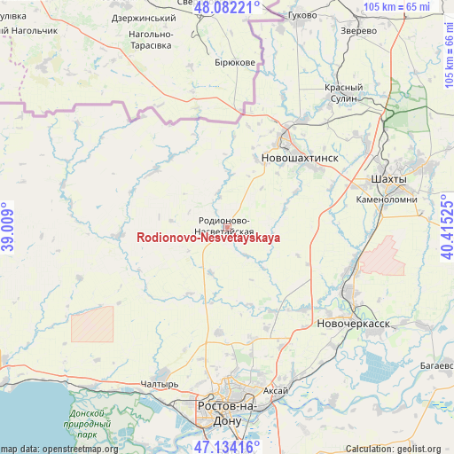
| Upper-left | 48.08221°, | 39.009° |
| Center: | 47.61033°, | 39.71212° |
| Lower-right: | 47.13416°, | 40.41525° |
| Map W x H: | 105.4×105.4 km | = 65.5×65.5mi |
| max Lat: | 73.50819° ⇑81% North |
| Rodionovo-Nesvetayskaya: | 47.61033° |
| min Lat: | ⇓19% South 41.28413° |
| min Long | Rodionovo-Nesve | max Long |
| -179.12198° | 39.71212° | 179.35046° |
| W 31%⇐ | ⇒69% E |
Elevation
Elevation of Rodionovo-Nesvetayskaya is 41 m = 135 ft, and this is 161.6 m = 530 ft below average elevation for this country.
| Max E: |
2518 m = 8261 ft | 86.7% |
| Avg. | 202.6 m = 665 ft | |
| Rodionovo-Nesvetayskaya | 41 m = 135 ft | |
Min E: |
-28 m = -92 ft | 13.3% |
See also: Russia elevation on elevation.city.
Geographical zone
Rodionovo-Nesvetayskaya is located in North temperate zone (between Tropic of Cancer and the Arctic Circle). Distance of this North polar circle is 2107.4 km =1309.5 mi to North.| Distance of | km | miles | from Rodionovo-Nesvetayskaya |
|---|---|---|---|
| North Pole | 4713.3 | 2928.7 | to North |
| Arctic Circle | 2107.4 | 1309.5 | to North |
| Tropic Cancer | 2687.9 | 1670.2 | to South |
| Equator | 5293.8 | 3289.4 | to South |


Nearby cities:
15 places around Rodionovo-Nesvetayskaya: (largest is in red/bold)
• Grushevskaya
26 km =16.2 mi,  136°
136°
• Imeni Chkalova
36.7 km =22.8 mi,  175°
175°
• Kamenolomni
37.5 km =23.3 mi,  80°
80°
• Krasyukovskaya
30.4 km =18.9 mi,  102°
102°
• Mayskiy
30.8 km =19.1 mi,  71°
71°
• Novocherkassk
35.4 km =22 mi,  126°
126°
• Novoshakhtinsk
23.5 km =14.6 mi,  44°
44°
• Novosvetlovsky
35.5 km =22.1 mi, 83°
• Persianovka
23.8 km =14.8 mi,  247°
247°
• Rodionovo-Nesvetaiskoye
1.5 km =0.9 mi,  218°
218°
• Sambek
17.2 km =10.7 mi,  31°
31°
• Severnyy
35.7 km =22.2 mi, 179°
• Sokolovo-Kundryuchenskiy
30.6 km =19 mi, 35°
• Talovyy
36.9 km =22.9 mi,  53°
53°
• Verkhnetemernitzkiy
33.3 km =20.7 mi, 176°
Sources, notices
• [Note1] Compared only with cities in Russia existing in our database
• [Src1] Map data: © OpenStreetMap contributors (CC-BY-SA)
• [Src2] Other city data from geonames.org with taken over terms of usage.
• [Src3] Geographical zone / Annual Mean Temperature by Robert A. Rohde @ Wikipedia
