Rzhaksa geodata
Rzhaksa (Tambov) is a populated place; located in Russia in Europe/Moscow (GMT+3) time zone. With population of 5,692 people, there are 2367 cities with bigger population in this country. Compared to other cities in Russia, 68.4% of cities are located further ↑North; 59.5% of cities are located further →East and 66.2% of cities have lower elevation than Rzhaksa. Note1


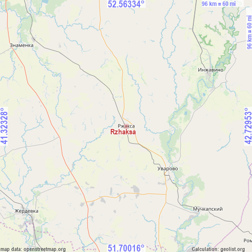
Rzhaksa GPS coordinates[2]
52° 8' 1.824" North, 42° 1' 35.04" East
| Map corner | latitude | longitude |
|---|---|---|
| Upper-left | 52.56334°, | 41.32328° |
| Center: | 52.13384°, | 42.0264° |
| Lower-right: | 51.70016°, | 42.72953° |
| Map W x H: | 96×96 km | = 59.7×59.7mi |
| max Lat: | 73.50819° ⇑68.4% North |
| Rzhaksa: | 52.13384° |
| min Lat: | ⇓31.6% South 41.28413° |
| min Long | Rzhaksa | max Long |
| -179.12198° | 42.0264° | 179.35046° |
| W 40.5%⇐ | ⇒59.5% E |
Elevation
Elevation of Rzhaksa is 185 m = 607 ft, and this is 17.6 m = 58 ft below average elevation for this country.
| Max E: |
2518 m = 8261 ft | 33.8% |
| Avg. | 202.6 m = 665 ft | |
| Rzhaksa | 185 m = 607 ft | |
Min E: |
-28 m = -92 ft | 66.2% |
See also: Russia elevation on elevation.city.
Geographical zone
Rzhaksa is located in North temperate zone (between Tropic of Cancer and the Arctic Circle). Distance of this North polar circle is 1604.4 km =996.9 mi to North.| Distance of | km | miles | from Rzhaksa |
|---|---|---|---|
| North Pole | 4210.3 | 2616.2 | to North |
| Arctic Circle | 1604.4 | 996.9 | to North |
| Tropic Cancer | 3190.8 | 1982.7 | to South |
| Equator | 5796.7 | 3601.9 | to South |


Nearby cities:
15 places around Rzhaksa: (largest is in red/bold)
• Bokino
67.9 km =42.2 mi,  325°
325°
• Bol’shoy Karay
74.4 km =46.2 mi,  142°
142°
• Inzhavino
37.9 km =23.5 mi,  57°
57°
• Kotovsk
61.7 km =38.3 mi,  324°
324°
• Muchkapskiy
43.8 km =27.2 mi, 135°
• Novaya Lyada
69.6 km =43.2 mi,  337°
337°
• Platonovka
64.3 km =40 mi,  355°
355°
• Pokrovo-Prigorodnoye
73.8 km =45.9 mi, 325°
• Rasskazovo
58.8 km =36.5 mi,  350°
350°
• Romanovka
66 km =41 mi,  131°
131°
• Satinka
36 km =22.4 mi, 319°
• Ternovka
57.3 km =35.6 mi,  207°
207°
• Uvarovo
23.1 km =14.4 mi, 135°
• Zherdevka
50.1 km =31.1 mi,  230°
230°
• Znamenka
51.3 km =31.9 mi,  307°
307°
Sources, notices
• [Note1] Compared only with cities in Russia existing in our database
• [Src1] Map data: © OpenStreetMap contributors (CC-BY-SA)
• [Src2] Other city data from geonames.org with taken over terms of usage.
• [Src3] Geographical zone / Annual Mean Temperature by Robert A. Rohde @ Wikipedia
