Ruskeala geodata
Ruskeala (Karelia) is a populated place; located in Russia in Europe/Moscow (GMT+3) time zone. With population of 3,000 people, there are 3766 cities with bigger population in this country. Compared to other cities in Russia, 94.8% of cities are located further ↓South; 95.1% of cities are located further →East and 71% of cities have higher elevation than Ruskeala. Note1


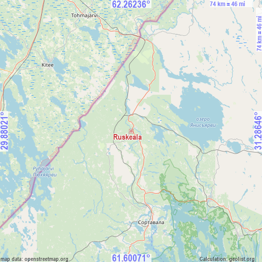
Ruskeala GPS coordinates[2]
61° 55' 59.988" North, 30° 34' 59.988" East
| Map corner | latitude | longitude |
|---|---|---|
| Upper-left | 62.26236°, | 29.88021° |
| Center: | 61.93333°, | 30.58333° |
| Lower-right: | 61.60071°, | 31.28646° |
| Map W x H: | 73.6×73.6 km | = 45.7×45.7mi |
| max Lat: | 73.50819° ⇑5.2% North |
| Ruskeala: | 61.93333° |
| min Lat: | ⇓94.8% South 41.28413° |
| min Long | Ruskeala | max Long |
| -179.12198° | 30.58333° | 179.35046° |
| W 4.9%⇐ | ⇒95.1% E |
Elevation
Elevation of Ruskeala is 100 m = 328 ft, and this is 102.6 m = 337 ft below average elevation for this country.
| Max E: |
2518 m = 8261 ft | 71% |
| Avg. | 202.6 m = 665 ft | |
| Ruskeala | 100 m = 328 ft | |
Min E: |
-28 m = -92 ft | 29% |
See also: Russia elevation on elevation.city.
Geographical zone
Ruskeala is located in North temperate zone (between Tropic of Cancer and the Arctic Circle). Distance of this North polar circle is 514.8 km =319.9 mi to North.| Distance of | km | miles | from Ruskeala |
|---|---|---|---|
| North Pole | 3120.7 | 1939.1 | to North |
| Arctic Circle | 514.8 | 319.9 | to North |
| Tropic Cancer | 4280.4 | 2659.7 | to South |
| Equator | 6886.3 | 4278.9 | to South |


Nearby cities:
15 places around Ruskeala: (largest is in red/bold)
• Kharlu
24.3 km =15.1 mi,  127°
127°
• Khelyulya
20.9 km =13 mi,  168°
168°
• Khiitola
90.5 km =56.2 mi,  211°
211°
• Kuznechnoye
98.4 km =61.1 mi,  202°
202°
• Lakhdenpokh’ya
50.2 km =31.2 mi, 203°
• Losevo
127.3 km =79.1 mi,  221°
221°
• Lyaskelya
29.2 km =18.1 mi, 130°
• Pitkyaranta
61.8 km =38.4 mi, 130°
• Priozërsk
102.3 km =63.6 mi,  193°
193°
• Salmi
91.7 km =57 mi, 133°
• Sortavala
25.5 km =15.8 mi,  164°
164°
• Suoyarvi
93.7 km =58.2 mi,  79°
79°
• Veshkelitsa
116.6 km =72.5 mi,  90°
90°
• Vyartsilya
27.6 km =17.1 mi,  11°
11°
• Yanis’yarvi
19.7 km =12.2 mi,  103°
103°
Sources, notices
• [Note1] Compared only with cities in Russia existing in our database
• [Src1] Map data: © OpenStreetMap contributors (CC-BY-SA)
• [Src2] Other city data from geonames.org with taken over terms of usage.
• [Src3] Geographical zone / Annual Mean Temperature by Robert A. Rohde @ Wikipedia
