Kharlu geodata
Kharlu (Karelia) is a populated place; located in Russia in Europe/Moscow (GMT+3) time zone. With population of 3,200 people, there are 3608 cities with bigger population in this country. Compared to other cities in Russia, 94.5% of cities are located further ↓South; 94.6% of cities are located further →East and 80.6% of cities have higher elevation than Kharlu. Note1


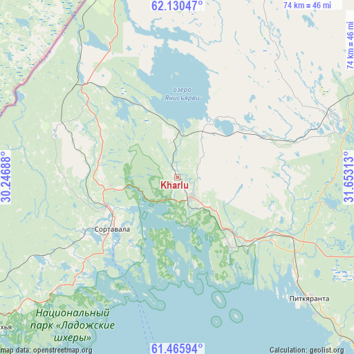
Kharlu GPS coordinates[2]
61° 48' 0" North, 30° 57' 0" East
| Map corner | latitude | longitude |
|---|---|---|
| Upper-left | 62.13047°, | 30.24688° |
| Center: | 61.8°, | 30.95° |
| Lower-right: | 61.46594°, | 31.65313° |
| Map W x H: | 73.9×73.9 km | = 45.9×45.9mi |
| max Lat: | 73.50819° ⇑5.5% North |
| Kharlu: | 61.8° |
| min Lat: | ⇓94.5% South 41.28413° |
| min Long | Kharlu | max Long |
| -179.12198° | 30.95° | 179.35046° |
| W 5.4%⇐ | ⇒94.6% E |
Elevation
Elevation of Kharlu is 69 m = 226 ft, and this is 133.6 m = 438 ft below average elevation for this country.
| Max E: |
2518 m = 8261 ft | 80.6% |
| Avg. | 202.6 m = 665 ft | |
| Kharlu | 69 m = 226 ft | |
Min E: |
-28 m = -92 ft | 19.4% |
See also: Russia elevation on elevation.city.
Geographical zone
Kharlu is located in North temperate zone (between Tropic of Cancer and the Arctic Circle). Distance of this North polar circle is 529.7 km =329.1 mi to North.| Distance of | km | miles | from Kharlu |
|---|---|---|---|
| North Pole | 3135.5 | 1948.3 | to North |
| Arctic Circle | 529.7 | 329.1 | to North |
| Tropic Cancer | 4265.6 | 2650.5 | to South |
| Equator | 6871.5 | 4269.8 | to South |


Nearby cities:
15 places around Kharlu: (largest is in red/bold)
• Essoyla
115.7 km =71.9 mi,  86°
86°
• Khelyulya
16 km =9.9 mi,  249°
249°
• Khiitola
91.4 km =56.8 mi,  226°
226°
• Kuznechnoye
95.2 km =59.2 mi,  216°
216°
• Lakhdenpokh’ya
50.4 km =31.3 mi, 231°
• Lyaskelya
5 km =3.1 mi,  144°
144°
• Pitkyaranta
37.6 km =23.4 mi,  132°
132°
• Priozërsk
95.2 km =59.2 mi,  207°
207°
• Ruskeala
24.3 km =15.1 mi,  307°
307°
• Salmi
67.6 km =42 mi, 135°
• Sortavala
16 km =9.9 mi, 232°
• Suoyarvi
79.7 km =49.5 mi,  66°
66°
• Veshkelitsa
98.6 km =61.3 mi,  82°
82°
• Vyartsilya
44 km =27.3 mi,  342°
342°
• Yanis’yarvi
10.1 km =6.3 mi,  359°
359°
Sources, notices
• [Note1] Compared only with cities in Russia existing in our database
• [Src1] Map data: © OpenStreetMap contributors (CC-BY-SA)
• [Src2] Other city data from geonames.org with taken over terms of usage.
• [Src3] Geographical zone / Annual Mean Temperature by Robert A. Rohde @ Wikipedia
