Rogovatoye geodata
Rogovatoye (Belgorod Oblast) is a populated place; located in Russia in Europe/Moscow (GMT+3) time zone. With population of 3,062 people, there are 3728 cities with bigger population in this country. Compared to other cities in Russia, 73.8% of cities are located further ↑North; 75% of cities are located further →East and 72.3% of cities have lower elevation than Rogovatoye. Note1


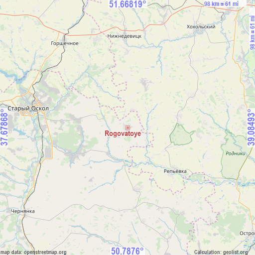
Rogovatoye GPS coordinates[2]
51° 13' 48" North, 38° 22' 54.48" East
| Map corner | latitude | longitude |
|---|---|---|
| Upper-left | 51.66819°, | 37.67868° |
| Center: | 51.23°, | 38.3818° |
| Lower-right: | 50.7876°, | 39.08493° |
| Map W x H: | 97.9×97.9 km | = 60.8×60.8mi |
| max Lat: | 73.50819° ⇑73.8% North |
| Rogovatoye: | 51.23° |
| min Lat: | ⇓26.2% South 41.28413° |
| min Long | Rogovatoye | max Long |
| -179.12198° | 38.3818° | 179.35046° |
| W 25%⇐ | ⇒75% E |
Elevation
Elevation of Rogovatoye is 206 m = 676 ft, and this is 3.4 m = 11 ft above average elevation for this country.
| Max E: |
2518 m = 8261 ft | 27.7% |
| Rogovatoye | 206 m 676 ft | |
| Avg. | 202.6 m = 665 ft | |
Min E: |
-28 m = -92 ft | 72.3% |
See also: Russia elevation on elevation.city.
Geographical zone
Rogovatoye is located in North temperate zone (between Tropic of Cancer and the Arctic Circle). Distance of this North polar circle is 1704.9 km =1059.4 mi to North.| Distance of | km | miles | from Rogovatoye |
|---|---|---|---|
| North Pole | 4310.8 | 2678.6 | to North |
| Arctic Circle | 1704.9 | 1059.4 | to North |
| Tropic Cancer | 3090.3 | 1920.2 | to South |
| Equator | 5696.2 | 3539.5 | to South |


Nearby cities:
15 places around Rogovatoye: (largest is in red/bold)
• Chernyanka
51.4 km =31.9 mi,  231°
231°
• Devitsa
59.6 km =37 mi,  40°
40°
• Gorshechnoye
40.6 km =25.2 mi,  323°
323°
• Gubkin
58.5 km =36.4 mi,  275°
275°
• Kolodeznyy
56.9 km =35.4 mi,  78°
78°
• Kostenki
48.9 km =30.4 mi,  68°
68°
• Krasnoye
39.4 km =24.5 mi,  147°
147°
• Latnaya
59.7 km =37.1 mi, 37°
• Nizhnedevitsk
34.7 km =21.6 mi,  358°
358°
• Novovoronezh
58.8 km =36.5 mi, 81°
• Olym
52 km =32.3 mi,  344°
344°
• Rossosh’
15.1 km =9.4 mi,  143°
143°
• Staryy Oskol
38.3 km =23.8 mi, 281°
• Strelitsa
55.8 km =34.7 mi, 41°
• Uryv-Pokrovka
56 km =34.8 mi,  103°
103°
Sources, notices
• [Note1] Compared only with cities in Russia existing in our database
• [Src1] Map data: © OpenStreetMap contributors (CC-BY-SA)
• [Src2] Other city data from geonames.org with taken over terms of usage.
• [Src3] Geographical zone / Annual Mean Temperature by Robert A. Rohde @ Wikipedia
