Nizhnedevitsk geodata
Nizhnedevitsk (Voronezj) is a populated place; located in Russia in Europe/Moscow (GMT+3) time zone. With population of 6,320 people, there are 2172 cities with bigger population in this country. Compared to other cities in Russia, 72.3% of cities are located further ↑North; 75.1% of cities are located further →East and 53.9% of cities have lower elevation than Nizhnedevitsk. Note1


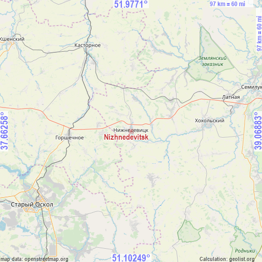
Nizhnedevitsk GPS coordinates[2]
51° 32' 30.84" North, 38° 21' 56.52" East
| Map corner | latitude | longitude |
|---|---|---|
| Upper-left | 51.9771°, | 37.66258° |
| Center: | 51.5419°, | 38.3657° |
| Lower-right: | 51.10249°, | 39.06883° |
| Map W x H: | 97.2×97.2 km | = 60.4×60.4mi |
| max Lat: | 73.50819° ⇑72.3% North |
| Nizhnedevitsk: | 51.5419° |
| min Lat: | ⇓27.7% South 41.28413° |
| min Long | Nizhnedevitsk | max Long |
| -179.12198° | 38.3657° | 179.35046° |
| W 24.9%⇐ | ⇒75.1% E |
Elevation
Elevation of Nizhnedevitsk is 154 m = 505 ft, and this is 48.6 m = 159 ft below average elevation for this country.
| Max E: |
2518 m = 8261 ft | 46.1% |
| Avg. | 202.6 m = 665 ft | |
| Nizhnedevitsk | 154 m = 505 ft | |
Min E: |
-28 m = -92 ft | 53.9% |
See also: Russia elevation on elevation.city.
Geographical zone
Nizhnedevitsk is located in North temperate zone (between Tropic of Cancer and the Arctic Circle). Distance of this North polar circle is 1670.3 km =1037.9 mi to North.| Distance of | km | miles | from Nizhnedevitsk |
|---|---|---|---|
| North Pole | 4276.1 | 2657 | to North |
| Arctic Circle | 1670.3 | 1037.9 | to North |
| Tropic Cancer | 3125 | 1941.8 | to South |
| Equator | 5730.9 | 3561 | to South |


Nearby cities:
15 places around Nizhnedevitsk: (largest is in red/bold)
• Devitsa
41.3 km =25.7 mi,  75°
75°
• Gorshechnoye
22.9 km =14.2 mi,  265°
265°
• Kastornoye
36.2 km =22.5 mi,  333°
333°
• Kostenki
49.3 km =30.6 mi,  109°
109°
• Kshenskiy
55.9 km =34.7 mi,  306°
306°
• Latnaya
39.2 km =24.4 mi,  70°
70°
• Olym
20.2 km =12.6 mi,  319°
319°
• Pridonskoy
51.3 km =31.9 mi, 72°
• Rogovatoye
34.7 km =21.6 mi,  178°
178°
• Rossosh’
47.9 km =29.8 mi,  167°
167°
• Semiluki
48.4 km =30.1 mi, 70°
• Shilovo
50 km =31.1 mi,  89°
89°
• Staryy Oskol
45.4 km =28.2 mi,  233°
233°
• Strelitsa
38.3 km =23.8 mi, 78°
• Zemlyansk
47.6 km =29.6 mi,  32°
32°
Sources, notices
• [Note1] Compared only with cities in Russia existing in our database
• [Src1] Map data: © OpenStreetMap contributors (CC-BY-SA)
• [Src2] Other city data from geonames.org with taken over terms of usage.
• [Src3] Geographical zone / Annual Mean Temperature by Robert A. Rohde @ Wikipedia
