Staryy Oskol geodata
Staryy Oskol (Belgorod Oblast) is a populated place; located in Russia in Europe/Moscow (GMT+3) time zone. With population of 226,977 people, there are 86 cities with bigger population in this country. Compared to other cities in Russia, 73.5% of cities are located further ↑North; 78.5% of cities are located further →East and 52.6% of cities have higher elevation than Staryy Oskol. Note1


Staryy Oskol GPS coordinates[2]
51° 17' 48.012" North, 37° 50' 30.012" East
| Map corner | latitude | longitude |
|---|---|---|
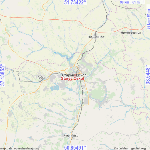
| Upper-left | 51.73422°, | 37.13855° |
| Center: | 51.29667°, | 37.84167° |
| Lower-right: | 50.85491°, | 38.5448° |
| Map W x H: | 97.8×97.8 km | = 60.8×60.8mi |
| max Lat: | 73.50819° ⇑73.5% North |
| Staryy Oskol: | 51.29667° |
| min Lat: | ⇓26.5% South 41.28413° |
| min Long | Staryy Oskol | max Long |
| -179.12198° | 37.84167° | 179.35046° |
| W 21.5%⇐ | ⇒78.5% E |
Elevation
Elevation of Staryy Oskol is 139 m = 456 ft, and this is 63.6 m = 209 ft below average elevation for this country.
| Max E: |
2518 m = 8261 ft | 52.6% |
| Avg. | 202.6 m = 665 ft | |
| Staryy Oskol | 139 m = 456 ft | |
Min E: |
-28 m = -92 ft | 47.4% |
See also: Staryy Oskol elevation on elevation.city.
Geographical zone
Staryy Oskol is located in North temperate zone (between Tropic of Cancer and the Arctic Circle). Distance of this North polar circle is 1697.5 km =1054.8 mi to North.| Distance of | km | miles | from Staryy Oskol |
|---|---|---|---|
| North Pole | 4303.4 | 2674 | to North |
| Arctic Circle | 1697.5 | 1054.8 | to North |
| Tropic Cancer | 3097.7 | 1924.8 | to South |
| Equator | 5703.7 | 3544.1 | to South |


Nearby cities:
15 places around Staryy Oskol: (largest is in red/bold)
• Bekhteyevka
69.7 km =43.3 mi,  218°
218°
• Chernyanka
39.6 km =24.6 mi,  183°
183°
• Gorshechnoye
28.7 km =17.8 mi,  28°
28°
• Gubkin
20.6 km =12.8 mi,  265°
265°
• Kastornoye
62.9 km =39.1 mi,  18°
18°
• Kshenskiy
61.1 km =38 mi,  351°
351°
• Manturovo
52.5 km =32.6 mi,  289°
289°
• Nizhnedevitsk
45.4 km =28.2 mi,  53°
53°
• Novyy Oskol
59.3 km =36.8 mi, 178°
• Olym
48.5 km =30.1 mi, 28°
• Rogovatoye
38.3 km =23.8 mi,  101°
101°
• Rossosh’
50.6 km =31.4 mi,  112°
112°
• Skorodnoye
49.6 km =30.8 mi,  239°
239°
• Tim
61.5 km =38.2 mi,  306°
306°
• Troitskiy
23 km =14.3 mi, 287°
Sources, notices
• [Note1] Compared only with cities in Russia existing in our database
• [Src1] Map data: © OpenStreetMap contributors (CC-BY-SA)
• [Src2] Other city data from geonames.org with taken over terms of usage.
• [Src3] Geographical zone / Annual Mean Temperature by Robert A. Rohde @ Wikipedia
