Radumlya geodata
Radumlya (Moscow Oblast) is a populated place; located in Russia in Europe/Moscow (GMT+3) time zone. With population of 2,250 people, there are 4049 cities with bigger population in this country. Compared to other cities in Russia, 67.6% of cities are located further ↓South; 84.4% of cities are located further →East and 66.2% of cities have lower elevation than Radumlya. Note1


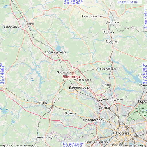
Radumlya GPS coordinates[2]
56° 4' 8.436" North, 37° 8' 59.244" East
| Map corner | latitude | longitude |
|---|---|---|
| Upper-left | 56.4595°, | 36.44667° |
| Center: | 56.06901°, | 37.14979° |
| Lower-right: | 55.67453°, | 37.85292° |
| Map W x H: | 87.3×87.3 km | = 54.2×54.2mi |
| max Lat: | 73.50819° ⇑32.4% North |
| Radumlya: | 56.06901° |
| min Lat: | ⇓67.6% South 41.28413° |
| min Long | Radumlya | max Long |
| -179.12198° | 37.14979° | 179.35046° |
| W 15.6%⇐ | ⇒84.4% E |
Elevation
Elevation of Radumlya is 185 m = 607 ft, and this is 17.6 m = 58 ft below average elevation for this country.
| Max E: |
2518 m = 8261 ft | 33.8% |
| Avg. | 202.6 m = 665 ft | |
| Radumlya | 185 m = 607 ft | |
Min E: |
-28 m = -92 ft | 66.2% |
See also: Russia elevation on elevation.city.
Geographical zone
Radumlya is located in North temperate zone (between Tropic of Cancer and the Arctic Circle). Distance of this North polar circle is 1166.9 km =725.1 mi to North.| Distance of | km | miles | from Radumlya |
|---|---|---|---|
| North Pole | 3772.8 | 2344.3 | to North |
| Arctic Circle | 1166.9 | 725.1 | to North |
| Tropic Cancer | 3628.4 | 2254.6 | to South |
| Equator | 6234.3 | 3873.8 | to South |


Nearby cities:
15 places around Radumlya: (largest is in red/bold)
• Alabushevo
5.8 km =3.6 mi,  179°
179°
• Andreyevka
9.9 km =6.2 mi,  185°
185°
• Brëkhovo
15.2 km =9.4 mi,  170°
170°
• Chashnikovo
4.1 km =2.5 mi, 165°
• Firsanovka
14 km =8.7 mi,  156°
156°
• Kamenka
15.8 km =9.8 mi,  36°
36°
• Lozhki
3.8 km =2.4 mi,  317°
317°
• Mendeleyevo
5.7 km =3.5 mi,  133°
133°
• Novopodrezkovo
18.8 km =11.7 mi,  139°
139°
• Peshki
8.8 km =5.5 mi, 324°
• Povarovo
6.2 km =3.9 mi,  267°
267°
• Rzhavki
9.9 km =6.2 mi, 140°
• Skhodnya
16.3 km =10.1 mi,  145°
145°
• Solnechnogorsk
16.4 km =10.2 mi, 320°
• Zelenograd
9.8 km =6.1 mi, 168°
Sources, notices
• [Note1] Compared only with cities in Russia existing in our database
• [Src1] Map data: © OpenStreetMap contributors (CC-BY-SA)
• [Src2] Other city data from geonames.org with taken over terms of usage.
• [Src3] Geographical zone / Annual Mean Temperature by Robert A. Rohde @ Wikipedia
