Proletarsk geodata
Proletarsk (Rostov) is a seat of a second-order administrative division; located in Russia in Europe/Moscow (GMT+3) time zone. With population of 19,493 people, there are 894 cities with bigger population in this country. Compared to other cities in Russia, 82.7% of cities are located further ↑North; 60.8% of cities are located further →East and 92.2% of cities have higher elevation than Proletarsk. Note1


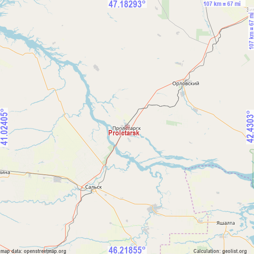
Proletarsk GPS coordinates[2]
46° 42' 10.404" North, 41° 43' 37.812" East
| Map corner | latitude | longitude |
|---|---|---|
| Upper-left | 47.18293°, | 41.02405° |
| Center: | 46.70289°, | 41.72717° |
| Lower-right: | 46.21855°, | 42.4303° |
| Map W x H: | 107.2×107.2 km | = 66.6×66.6mi |
| max Lat: | 73.50819° ⇑82.7% North |
| Proletarsk: | 46.70289° |
| min Lat: | ⇓17.3% South 41.28413° |
| min Long | Proletarsk | max Long |
| -179.12198° | 41.72717° | 179.35046° |
| W 39.2%⇐ | ⇒60.8% E |
Elevation
Elevation of Proletarsk is 21 m = 69 ft, and this is 181.6 m = 596 ft below average elevation for this country.
| Max E: |
2518 m = 8261 ft | 92.2% |
| Avg. | 202.6 m = 665 ft | |
| Proletarsk | 21 m = 69 ft | |
Min E: |
-28 m = -92 ft | 7.8% |
See also: Russia elevation on elevation.city.
Geographical zone
Proletarsk is located in North temperate zone (between Tropic of Cancer and the Arctic Circle). Distance of this North polar circle is 2208.3 km =1372.2 mi to North.| Distance of | km | miles | from Proletarsk |
|---|---|---|---|
| North Pole | 4814.2 | 2991.4 | to North |
| Arctic Circle | 2208.3 | 1372.2 | to North |
| Tropic Cancer | 2587 | 1607.5 | to South |
| Equator | 5192.9 | 3226.7 | to South |


Nearby cities:
15 places around Proletarsk: (largest is in red/bold)
• Bol’shaya Martynovka
63.7 km =39.6 mi,  355°
355°
• Gigant
36.6 km =22.7 mi,  233°
233°
• Gorodoviki
65.7 km =40.8 mi,  163°
163°
• Gorodovikovsk
70.2 km =43.6 mi,  166°
166°
• Gundorovskiy
15.5 km =9.6 mi,  56°
56°
• Krasnaya Polyana
67.8 km =42.1 mi,  194°
194°
• Krasnoarmeyskiy
50.1 km =31.1 mi,  46°
46°
• Novyy Yegorlyk
36.2 km =22.5 mi, 162°
• Orlovskiy
31.5 km =19.6 mi, 53°
• Sal’sk
29.1 km =18.1 mi,  209°
209°
• Sandata
48.1 km =29.9 mi,  177°
177°
• Sovetskoye
32 km =19.9 mi,  86°
86°
• Tselina
56.3 km =35 mi,  250°
250°
• Volochayevskiy
72.8 km =45.2 mi,  104°
104°
• Yashalta
58.3 km =36.2 mi,  133°
133°
Sources, notices
• [Note1] Compared only with cities in Russia existing in our database
• [Src1] Map data: © OpenStreetMap contributors (CC-BY-SA)
• [Src2] Other city data from geonames.org with taken over terms of usage.
• [Src3] Geographical zone / Annual Mean Temperature by Robert A. Rohde @ Wikipedia
