Krasnokumskoye geodata
Krasnokumskoye (Stavropol’ Kray) is a populated place; located in Russia in Europe/Moscow (GMT+3) time zone. With population of 13,630 people, there are 1161 cities with bigger population in this country. Compared to other cities in Russia, 90.9% of cities are located further ↑North; 54.7% of cities are located further →East and 79.9% of cities have lower elevation than Krasnokumskoye. Note1


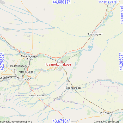
Krasnokumskoye GPS coordinates[2]
44° 10' 41.016" North, 43° 30' 6.984" East
| Map corner | latitude | longitude |
|---|---|---|
| Upper-left | 44.68017°, | 42.79882° |
| Center: | 44.17806°, | 43.50194° |
| Lower-right: | 43.67164°, | 44.20507° |
| Map W x H: | 112.1×112.1 km | = 69.7×69.7mi |
| max Lat: | 73.50819° ⇑90.9% North |
| Krasnokumskoye: | 44.17806° |
| min Lat: | ⇓9.1% South 41.28413° |
| min Long | Krasnokumskoye | max Long |
| -179.12198° | 43.50194° | 179.35046° |
| W 45.3%⇐ | ⇒54.7% E |
Elevation
Elevation of Krasnokumskoye is 247 m = 810 ft, and this is 44.4 m = 146 ft above average elevation for this country.
| Max E: |
2518 m = 8261 ft | 20.1% |
| Krasnokumskoye | 247 m 810 ft | |
| Avg. | 202.6 m = 665 ft | |
Min E: |
-28 m = -92 ft | 79.9% |
See also: Russia elevation on elevation.city.
Geographical zone
Krasnokumskoye is located in North temperate zone (between Tropic of Cancer and the Arctic Circle). Distance of this Northern Tropic circle is 2306.2 km =1433 mi to South.| Distance of | km | miles | from Krasnokumskoye |
|---|---|---|---|
| North Pole | 5094.9 | 3165.8 | to North |
| Arctic Circle | 2489 | 1546.6 | to North |
| Tropic Cancer | 2306.2 | 1433 | to South |
| Equator | 4912.1 | 3052.2 | to South |


Nearby cities:
15 places around Krasnokumskoye: (largest is in red/bold)
• Aleksandriyskaya
13.6 km =8.5 mi,  293°
293°
• Georgiyevsk
3.9 km =2.4 mi,  221°
221°
• Georgiyevskaya
7.5 km =4.7 mi,  185°
185°
• Komsomolets
18.4 km =11.4 mi,  162°
162°
• Levokumka
28.7 km =17.8 mi,  281°
281°
• Lysogorskaya
19.7 km =12.2 mi,  246°
246°
• Mineralnye Vody
29.4 km =18.3 mi, 276°
• Nezlobnaya
10.3 km =6.4 mi,  229°
229°
• Novopavlovsk
26.2 km =16.3 mi, 156°
• Novozavedennoye
14.4 km =8.9 mi,  49°
49°
• Podgornaya
6.4 km =4 mi,  295°
295°
• Podkumskiy
25.9 km =16.1 mi,  243°
243°
• Pyatigorskiy
29.9 km =18.6 mi, 220°
• Soldato-Aleksandrovskoye
22.5 km =14 mi,  64°
64°
• Zmeyka
30.7 km =19.1 mi,  262°
262°
Sources, notices
• [Note1] Compared only with cities in Russia existing in our database
• [Src1] Map data: © OpenStreetMap contributors (CC-BY-SA)
• [Src2] Other city data from geonames.org with taken over terms of usage.
• [Src3] Geographical zone / Annual Mean Temperature by Robert A. Rohde @ Wikipedia
