Komsomolets geodata
Komsomolets (Stavropol’ Kray) is a populated place; located in Russia in Europe/Moscow (GMT+3) time zone. With population of 3,143 people, there are 3655 cities with bigger population in this country. Compared to other cities in Russia, 91.8% of cities are located further ↑North; 54.4% of cities are located further →East and 85% of cities have lower elevation than Komsomolets. Note1


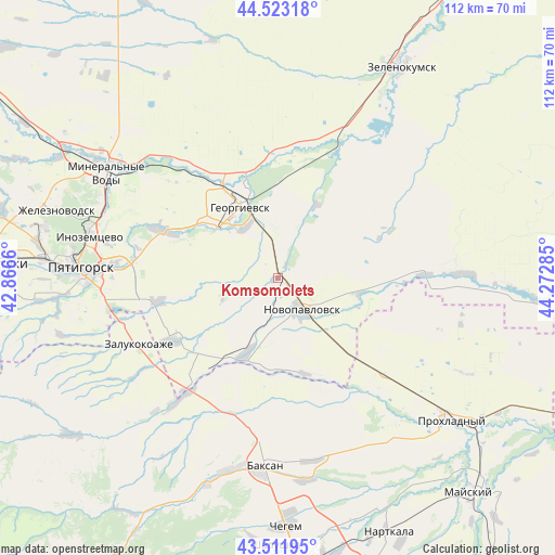
Komsomolets GPS coordinates[2]
44° 1' 10.992" North, 43° 34' 10.992" East
| Map corner | latitude | longitude |
|---|---|---|
| Upper-left | 44.52318°, | 42.8666° |
| Center: | 44.01972°, | 43.56972° |
| Lower-right: | 43.51195°, | 44.27285° |
| Map W x H: | 112.4×112.4 km | = 69.8×69.8mi |
| max Lat: | 73.50819° ⇑91.8% North |
| Komsomolets: | 44.01972° |
| min Lat: | ⇓8.2% South 41.28413° |
| min Long | Komsomolets | max Long |
| -179.12198° | 43.56972° | 179.35046° |
| W 45.6%⇐ | ⇒54.4% E |
Elevation
Elevation of Komsomolets is 320 m = 1050 ft, and this is 117.4 m = 385 ft above average elevation for this country.
| Max E: |
2518 m = 8261 ft | 15% |
| Komsomolets | 320 m 1050 ft | |
| Avg. | 202.6 m = 665 ft | |
Min E: |
-28 m = -92 ft | 85% |
See also: Russia elevation on elevation.city.
Geographical zone
Komsomolets is located in North temperate zone (between Tropic of Cancer and the Arctic Circle). Distance of this Northern Tropic circle is 2288.6 km =1422.1 mi to South.| Distance of | km | miles | from Komsomolets |
|---|---|---|---|
| North Pole | 5112.5 | 3176.8 | to North |
| Arctic Circle | 2506.6 | 1557.5 | to North |
| Tropic Cancer | 2288.6 | 1422.1 | to South |
| Equator | 4894.5 | 3041.3 | to South |


Nearby cities:
15 places around Komsomolets: (largest is in red/bold)
• Aleksandriyskaya
29.2 km =18.1 mi,  322°
322°
• Georgiyevsk
16.7 km =10.4 mi,  331°
331°
• Georgiyevskaya
11.9 km =7.4 mi, 328°
• Karagach
29 km =18 mi,  145°
145°
• Krasnokumskoye
18.4 km =11.4 mi,  342°
342°
• Kuba-Taba
28.9 km =18 mi,  200°
200°
• Lysogorskaya
25.4 km =15.8 mi,  292°
292°
• Nezlobnaya
17.2 km =10.7 mi,  309°
309°
• Novopavlovsk
8.2 km =5.1 mi,  141°
141°
• Novozavedennoye
27.6 km =17.1 mi,  11°
11°
• Podgornaya
23.2 km =14.4 mi, 331°
• Podkumskiy
29.4 km =18.3 mi,  282°
282°
• Pyatigorskiy
25.4 km =15.8 mi,  258°
258°
• Soldatskaya
29.9 km =18.6 mi, 138°
• Staropavlovskaya
19.7 km =12.2 mi,  165°
165°
Sources, notices
• [Note1] Compared only with cities in Russia existing in our database
• [Src1] Map data: © OpenStreetMap contributors (CC-BY-SA)
• [Src2] Other city data from geonames.org with taken over terms of usage.
• [Src3] Geographical zone / Annual Mean Temperature by Robert A. Rohde @ Wikipedia
