Pil’na geodata
Pil’na (Nizhny Novgorod Oblast) is a populated place; located in Russia in Europe/Moscow (GMT+3) time zone. With population of 6,835 people, there are 2039 cities with bigger population in this country. Compared to other cities in Russia, 58.8% of cities are located further ↓South; 52.6% of cities are located further ←West and 75.8% of cities have higher elevation than Pil’na. Note1


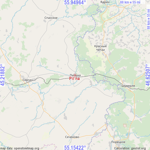
Pil’na GPS coordinates[2]
55° 33' 14.184" North, 45° 55' 18.984" East
| Map corner | latitude | longitude |
|---|---|---|
| Upper-left | 55.94964°, | 45.21882° |
| Center: | 55.55394°, | 45.92194° |
| Lower-right: | 55.15422°, | 46.62507° |
| Map W x H: | 88.4×88.4 km | = 54.9×54.9mi |
| max Lat: | 73.50819° ⇑41.2% North |
| Pil’na: | 55.55394° |
| min Lat: | ⇓58.8% South 41.28413° |
| min Long | Pil’na | max Long |
| -179.12198° | 45.92194° | 179.35046° |
| W 52.6%⇐ | ⇒47.4% E |
Elevation
Elevation of Pil’na is 85 m = 279 ft, and this is 117.6 m = 386 ft below average elevation for this country.
| Max E: |
2518 m = 8261 ft | 75.8% |
| Avg. | 202.6 m = 665 ft | |
| Pil’na | 85 m = 279 ft | |
Min E: |
-28 m = -92 ft | 24.2% |
See also: Russia elevation on elevation.city.
Geographical zone
Pil’na is located in North temperate zone (between Tropic of Cancer and the Arctic Circle). Distance of this North polar circle is 1224.2 km =760.7 mi to North.| Distance of | km | miles | from Pil’na |
|---|---|---|---|
| North Pole | 3830 | 2379.9 | to North |
| Arctic Circle | 1224.2 | 760.7 | to North |
| Tropic Cancer | 3571.1 | 2219 | to South |
| Equator | 6177 | 3838.2 | to South |


Nearby cities:
15 places around Pil’na: (largest is in red/bold)
• Alikovo
56.1 km =34.9 mi,  68°
68°
• Buturlino
64.4 km =40 mi,  271°
271°
• Knyaginino
63.1 km =39.2 mi,  298°
298°
• Krasnaya Gorka
22 km =13.7 mi,  147°
147°
• Krasnyye Chetai
20.2 km =12.6 mi,  42°
42°
• Poretskoye
47.3 km =29.4 mi, 147°
• Sechenovo
36.7 km =22.8 mi,  183°
183°
• Sergach
28.8 km =17.9 mi,  264°
264°
• Shumerlya
31.5 km =19.6 mi,  100°
100°
• Spasskoye
36.9 km =22.9 mi,  337°
337°
• Urazovka
25.6 km =15.9 mi,  228°
228°
• Vasil’sursk
64.5 km =40.1 mi,  5°
5°
• Vorotynets
56.4 km =35 mi,  356°
356°
• Vurnary
66 km =41 mi, 96°
• Yadrin
46.5 km =28.9 mi,  22°
22°
Sources, notices
• [Note1] Compared only with cities in Russia existing in our database
• [Src1] Map data: © OpenStreetMap contributors (CC-BY-SA)
• [Src2] Other city data from geonames.org with taken over terms of usage.
• [Src3] Geographical zone / Annual Mean Temperature by Robert A. Rohde @ Wikipedia
