Atkarsk geodata
Atkarsk (Saratovskaya Oblast) is a populated place; located in Russia in Europe/Saratov (GMT+4) time zone. With population of 27,554 people, there are 711 cities with bigger population in this country. Compared to other cities in Russia, 69.9% of cities are located further ↑North; 50.1% of cities are located further ←West and 59.9% of cities have lower elevation than Atkarsk. Note1


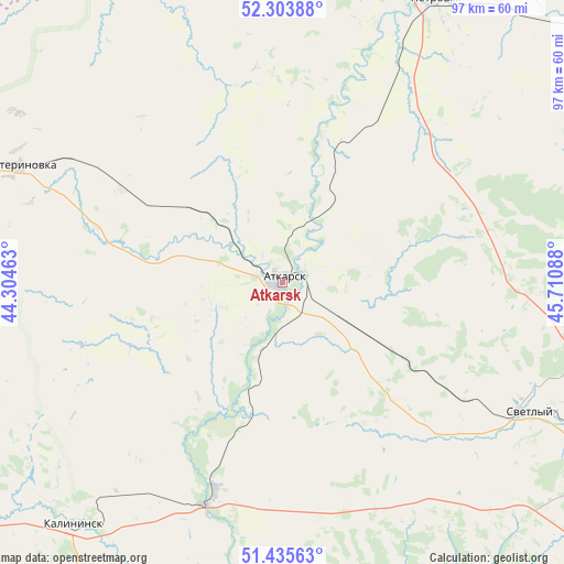
Atkarsk GPS coordinates[2]
51° 52' 18.66" North, 45° 0' 27.9" East
| Map corner | latitude | longitude |
|---|---|---|
| Upper-left | 52.30388°, | 44.30463° |
| Center: | 51.87185°, | 45.00775° |
| Lower-right: | 51.43563°, | 45.71088° |
| Map W x H: | 96.5×96.5 km | = 60×60mi |
| max Lat: | 73.50819° ⇑69.9% North |
| Atkarsk: | 51.87185° |
| min Lat: | ⇓30.1% South 41.28413° |
| min Long | Atkarsk | max Long |
| -179.12198° | 45.00775° | 179.35046° |
| W 50.1%⇐ | ⇒49.9% E |
Elevation
Elevation of Atkarsk is 168 m = 551 ft, and this is 34.6 m = 114 ft below average elevation for this country.
| Max E: |
2518 m = 8261 ft | 40.1% |
| Avg. | 202.6 m = 665 ft | |
| Atkarsk | 168 m = 551 ft | |
Min E: |
-28 m = -92 ft | 59.9% |
See also: Russia elevation on elevation.city.
Geographical zone
Atkarsk is located in North temperate zone (between Tropic of Cancer and the Arctic Circle). Distance of this North polar circle is 1633.6 km =1015.1 mi to North.| Distance of | km | miles | from Atkarsk |
|---|---|---|---|
| North Pole | 4239.5 | 2634.3 | to North |
| Arctic Circle | 1633.6 | 1015.1 | to North |
| Tropic Cancer | 3161.7 | 1964.6 | to South |
| Equator | 5767.6 | 3583.8 | to South |


Nearby cities:
15 places around Atkarsk: (largest is in red/bold)
• Engel’s
87.1 km =54.1 mi,  119°
119°
• Kalininsk
55.3 km =34.4 mi,  221°
221°
• Krasnyy Oktyabr’
60.5 km =37.6 mi,  127°
127°
• Lysyye Gory
37.5 km =23.3 mi,  197°
197°
• Malaya Serdoba
66.2 km =41.1 mi,  356°
356°
• Novyye Burasy
78.4 km =48.7 mi,  68°
68°
• Petrovsk
55 km =34.2 mi,  28°
28°
• Privolzhskiy
88.3 km =54.9 mi, 125°
• Saratov
78.2 km =48.6 mi, 118°
• Serdobsk
84.7 km =52.6 mi,  320°
320°
• Shumeyka
92.1 km =57.2 mi,  111°
111°
• Sokolovyy
66.1 km =41.1 mi, 120°
• Svetlyy
48.2 km =30 mi, 117°
• Tatishchevo
46.2 km =28.7 mi, 119°
• Yekaterinovka
49.6 km =30.8 mi,  293°
293°
Sources, notices
• [Note1] Compared only with cities in Russia existing in our database
• [Src1] Map data: © OpenStreetMap contributors (CC-BY-SA)
• [Src2] Other city data from geonames.org with taken over terms of usage.
• [Src3] Geographical zone / Annual Mean Temperature by Robert A. Rohde @ Wikipedia
