Panino geodata
Panino (Voronezj) is a populated place; located in Russia in Europe/Moscow (GMT+3) time zone. With population of 7,164 people, there are 1961 cities with bigger population in this country. Compared to other cities in Russia, 71.7% of cities are located further ↑North; 66.9% of cities are located further →East and 62.4% of cities have lower elevation than Panino. Note1


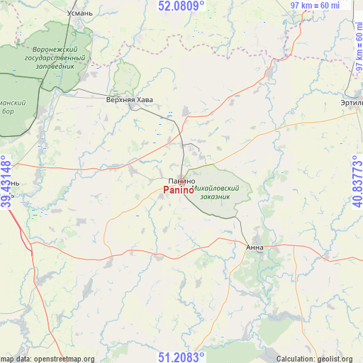
Panino GPS coordinates[2]
51° 38' 48.12" North, 40° 8' 4.56" East
| Map corner | latitude | longitude |
|---|---|---|
| Upper-left | 52.0809°, | 39.43148° |
| Center: | 51.6467°, | 40.1346° |
| Lower-right: | 51.2083°, | 40.83773° |
| Map W x H: | 97×97 km | = 60.3×60.3mi |
| max Lat: | 73.50819° ⇑71.7% North |
| Panino: | 51.6467° |
| min Lat: | ⇓28.3% South 41.28413° |
| min Long | Panino | max Long |
| -179.12198° | 40.1346° | 179.35046° |
| W 33.1%⇐ | ⇒66.9% E |
Elevation
Elevation of Panino is 175 m = 574 ft, and this is 27.6 m = 91 ft below average elevation for this country.
| Max E: |
2518 m = 8261 ft | 37.6% |
| Avg. | 202.6 m = 665 ft | |
| Panino | 175 m = 574 ft | |
Min E: |
-28 m = -92 ft | 62.4% |
See also: Russia elevation on elevation.city.
Geographical zone
Panino is located in North temperate zone (between Tropic of Cancer and the Arctic Circle). Distance of this North polar circle is 1658.6 km =1030.6 mi to North.| Distance of | km | miles | from Panino |
|---|---|---|---|
| North Pole | 4264.5 | 2649.8 | to North |
| Arctic Circle | 1658.6 | 1030.6 | to North |
| Tropic Cancer | 3136.7 | 1949.1 | to South |
| Equator | 5742.6 | 3568.3 | to South |


Nearby cities:
15 places around Panino: (largest is in red/bold)
• Anna
27.3 km =17 mi,  131°
131°
• Ertil’
51 km =31.7 mi,  64°
64°
• Kashirskoye
44.1 km =27.4 mi,  235°
235°
• Krasnolesnyy
45.8 km =28.5 mi,  304°
304°
• Novaya Usman’
50.1 km =31.1 mi,  269°
269°
• Orlovo
39.6 km =24.6 mi,  287°
287°
• Pereleshino
10.1 km =6.3 mi,  1°
1°
• Pereleshinskiy
8.7 km =5.4 mi,  28°
28°
• Podkletnoye
46.8 km =29.1 mi,  262°
262°
• Sadovoye
28.4 km =17.6 mi,  116°
116°
• Uglyanets
41.7 km =25.9 mi, 297°
• Usman’
52.5 km =32.6 mi,  327°
327°
• Verkhnyaya Khava
25.3 km =15.7 mi, 328°
• Verkhnyaya Tishanka
45.3 km =28.1 mi,  142°
142°
• Volya
43 km =26.7 mi, 287°
Sources, notices
• [Note1] Compared only with cities in Russia existing in our database
• [Src1] Map data: © OpenStreetMap contributors (CC-BY-SA)
• [Src2] Other city data from geonames.org with taken over terms of usage.
• [Src3] Geographical zone / Annual Mean Temperature by Robert A. Rohde @ Wikipedia
