Mostovskoy geodata
Mostovskoy (Krasnodarskiy) is a seat of a second-order administrative division; located in Russia in Europe/Moscow (GMT+3) time zone. With population of 25,188 people, there are 746 cities with bigger population in this country. Compared to other cities in Russia, 89.7% of cities are located further ↑North; 63.9% of cities are located further →East and 87.4% of cities have lower elevation than Mostovskoy. Note1


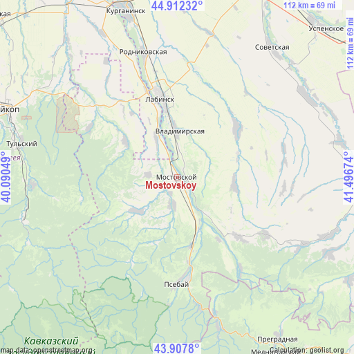
Mostovskoy GPS coordinates[2]
44° 24' 43.992" North, 40° 47' 36.996" East
| Map corner | latitude | longitude |
|---|---|---|
| Upper-left | 44.91232°, | 40.09049° |
| Center: | 44.41222°, | 40.79361° |
| Lower-right: | 43.9078°, | 41.49674° |
| Map W x H: | 111.7×111.7 km | = 69.4×69.4mi |
| max Lat: | 73.50819° ⇑89.7% North |
| Mostovskoy: | 44.41222° |
| min Lat: | ⇓10.3% South 41.28413° |
| min Long | Mostovskoy | max Long |
| -179.12198° | 40.79361° | 179.35046° |
| W 36.1%⇐ | ⇒63.9% E |
Elevation
Elevation of Mostovskoy is 380 m = 1247 ft, and this is 177.4 m = 582 ft above average elevation for this country.
| Max E: |
2518 m = 8261 ft | 12.6% |
| Mostovskoy | 380 m 1247 ft | |
| Avg. | 202.6 m = 665 ft | |
Min E: |
-28 m = -92 ft | 87.4% |
See also: Russia elevation on elevation.city.
Geographical zone
Mostovskoy is located in North temperate zone (between Tropic of Cancer and the Arctic Circle). Distance of this Northern Tropic circle is 2332.3 km =1449.2 mi to South.| Distance of | km | miles | from Mostovskoy |
|---|---|---|---|
| North Pole | 5068.9 | 3149.7 | to North |
| Arctic Circle | 2463 | 1530.4 | to North |
| Tropic Cancer | 2332.3 | 1449.2 | to South |
| Equator | 4938.2 | 3068.5 | to South |


Nearby cities:
15 places around Mostovskoy: (largest is in red/bold)
• Abadzekhskaya
45.5 km =28.3 mi,  267°
267°
• Besleneyevskaya
20.9 km =13 mi,  195°
195°
• Chamlykskaya
34.4 km =21.4 mi,  11°
11°
• Gubskaya
16.5 km =10.3 mi,  229°
229°
• Khodz’
12.6 km =7.8 mi,  329°
329°
• Labinsk
25.1 km =15.6 mi,  349°
349°
• Natyrbovo
37.7 km =23.4 mi,  339°
339°
• Perepravnaya
8.4 km =5.2 mi,  184°
184°
• Psebay
32.1 km =19.9 mi, 177°
• Rodnikovskaya
40.5 km =25.2 mi, 345°
• Shedok
22 km =13.7 mi,  168°
168°
• Upornaya
18.1 km =11.2 mi,  97°
97°
• Vladimirskaya
14.8 km =9.2 mi,  359°
359°
• Voznesenskaya
24.5 km =15.2 mi,  50°
50°
• Yaroslavskaya
34.2 km =21.3 mi,  310°
310°
Sources, notices
• [Note1] Compared only with cities in Russia existing in our database
• [Src1] Map data: © OpenStreetMap contributors (CC-BY-SA)
• [Src2] Other city data from geonames.org with taken over terms of usage.
• [Src3] Geographical zone / Annual Mean Temperature by Robert A. Rohde @ Wikipedia
