Yaroslavskaya geodata
Yaroslavskaya (Krasnodarskiy) is a populated place; located in Russia in Europe/Moscow (GMT+3) time zone. With population of 5,458 people, there are 2453 cities with bigger population in this country. Compared to other cities in Russia, 89.1% of cities are located further ↑North; 65.2% of cities are located further →East and 81.4% of cities have lower elevation than Yaroslavskaya. Note1


Yaroslavskaya GPS coordinates[2]
44° 36' 38.016" North, 40° 27' 51.012" East
| Map corner | latitude | longitude |
|---|---|---|
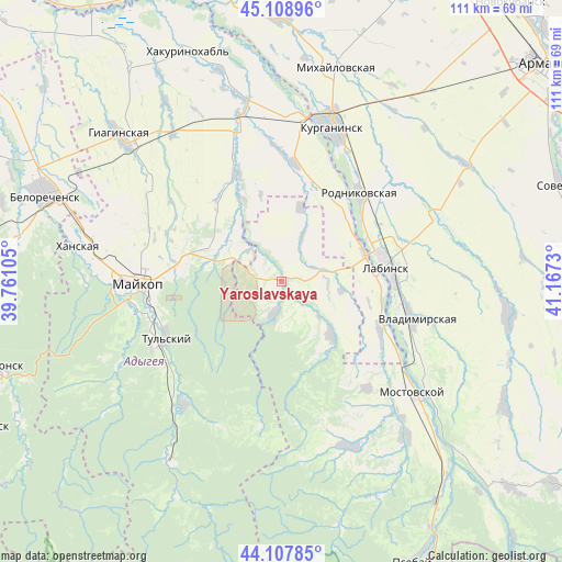
| Upper-left | 45.10896°, | 39.76105° |
| Center: | 44.61056°, | 40.46417° |
| Lower-right: | 44.10785°, | 41.1673° |
| Map W x H: | 111.3×111.3 km | = 69.2×69.2mi |
| max Lat: | 73.50819° ⇑89.1% North |
| Yaroslavskaya: | 44.61056° |
| min Lat: | ⇓10.9% South 41.28413° |
| min Long | Yaroslavskaya | max Long |
| -179.12198° | 40.46417° | 179.35046° |
| W 34.8%⇐ | ⇒65.2% E |
Elevation
Elevation of Yaroslavskaya is 264 m = 866 ft, and this is 61.4 m = 201 ft above average elevation for this country.
| Max E: |
2518 m = 8261 ft | 18.6% |
| Yaroslavskaya | 264 m 866 ft | |
| Avg. | 202.6 m = 665 ft | |
Min E: |
-28 m = -92 ft | 81.4% |
See also: Russia elevation on elevation.city.
Geographical zone
Yaroslavskaya is located in North temperate zone (between Tropic of Cancer and the Arctic Circle). Distance of this Northern Tropic circle is 2354.3 km =1462.9 mi to South.| Distance of | km | miles | from Yaroslavskaya |
|---|---|---|---|
| North Pole | 5046.8 | 3135.9 | to North |
| Arctic Circle | 2440.9 | 1516.7 | to North |
| Tropic Cancer | 2354.3 | 1462.9 | to South |
| Equator | 4960.2 | 3082.1 | to South |


Nearby cities:
15 places around Yaroslavskaya: (largest is in red/bold)
• Abadzekhskaya
30.8 km =19.1 mi,  218°
218°
• Blechepsin
23.5 km =14.6 mi,  6°
6°
• Dondukovskaya
31.2 km =19.4 mi,  345°
345°
• Khodz’
22.7 km =14.1 mi,  119°
119°
• Konstantinovskaya
32.5 km =20.2 mi,  39°
39°
• Koshekhabl’
32.1 km =19.9 mi, 6°
• Kurganinsk
31.8 km =19.8 mi,  19°
19°
• Kuzhorskaya
14.1 km =8.8 mi,  300°
300°
• Labinsk
21.6 km =13.4 mi,  83°
83°
• Maykop
28.4 km =17.6 mi,  269°
269°
• Mostovskoy
34.2 km =21.3 mi,  130°
130°
• Natyrbovo
18.5 km =11.5 mi, 44°
• Rodnikovskaya
23.4 km =14.5 mi, 42°
• Tul’skiy
25 km =15.5 mi,  244°
244°
• Vladimirskaya
27.1 km =16.8 mi,  105°
105°
Sources, notices
• [Note1] Compared only with cities in Russia existing in our database
• [Src1] Map data: © OpenStreetMap contributors (CC-BY-SA)
• [Src2] Other city data from geonames.org with taken over terms of usage.
• [Src3] Geographical zone / Annual Mean Temperature by Robert A. Rohde @ Wikipedia
