Kovdor geodata
Kovdor (Murmansk) is a populated place; located in Russia in Europe/Moscow (GMT+3) time zone. With population of 19,518 people, there are 890 cities with bigger population in this country. Compared to other cities in Russia, 98.8% of cities are located further ↓South; 95.4% of cities are located further →East and 78% of cities have lower elevation than Kovdor. Note1


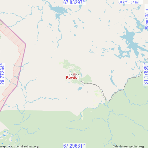
Kovdor GPS coordinates[2]
67° 33' 58.176" North, 30° 28' 32.736" East
| Map corner | latitude | longitude |
|---|---|---|
| Upper-left | 67.83297°, | 29.77264° |
| Center: | 67.56616°, | 30.47576° |
| Lower-right: | 67.29631°, | 31.17889° |
| Map W x H: | 59.7×59.7 km | = 37.1×37.1mi |
| max Lat: | 73.50819° ⇑1.2% North |
| Kovdor: | 67.56616° |
| min Lat: | ⇓98.8% South 41.28413° |
| min Long | Kovdor | max Long |
| -179.12198° | 30.47576° | 179.35046° |
| W 4.6%⇐ | ⇒95.4% E |
Elevation
Elevation of Kovdor is 233 m = 764 ft, and this is 30.4 m = 100 ft above average elevation for this country.
| Max E: |
2518 m = 8261 ft | 22% |
| Kovdor | 233 m 764 ft | |
| Avg. | 202.6 m = 665 ft | |
Min E: |
-28 m = -92 ft | 78% |
See also: Russia elevation on elevation.city.
Geographical zone
Kovdor is located in North Frigid zone (between North Pole and Arctic Circle). Distance of this North polar circle is 111.5 km =69.3 mi to South.| Distance of | km | miles | from Kovdor |
|---|---|---|---|
| North Pole | 2494.4 | 1549.9 | to North |
| Arctic Circle | 111.5 | 69.3 | to South |
| Tropic Cancer | 4906.7 | 3048.9 | to South |
| Equator | 7512.7 | 4668.2 | to South |


Nearby cities:
15 places around Kovdor: (largest is in red/bold)
• Afrikanda
99.1 km =61.6 mi,  97°
97°
• Alakurtti
66.8 km =41.5 mi,  184°
184°
• Apatity
124.2 km =77.2 mi,  90°
90°
• Kandalaksha
94.3 km =58.6 mi,  118°
118°
• Kirovsk
135.6 km =84.3 mi, 87°
• Koashva
153 km =95.1 mi, 86°
• Monchegorsk
109.2 km =67.9 mi,  67°
67°
• Murmashi
169.1 km =105.1 mi,  34°
34°
• Olenegorsk
132.9 km =82.6 mi,  61°
61°
• Polyarnyye Zori
89 km =55.3 mi, 104°
• Poyakonda
148.3 km =92.1 mi,  136°
136°
• Verkhnetulomskiy
128.1 km =79.6 mi, 25°
• Vysokiy
138.7 km =86.2 mi, 62°
• Zasheyek
90 km =55.9 mi, 101°
• Zelenoborskiy
114.2 km =71 mi,  134°
134°
Sources, notices
• [Note1] Compared only with cities in Russia existing in our database
• [Src1] Map data: © OpenStreetMap contributors (CC-BY-SA)
• [Src2] Other city data from geonames.org with taken over terms of usage.
• [Src3] Geographical zone / Annual Mean Temperature by Robert A. Rohde @ Wikipedia
