Kologriv geodata
Kologriv (Kostroma Oblast) is a populated place; located in Russia in Europe/Moscow (GMT+3) time zone. With population of 3,605 people, there are 3332 cities with bigger population in this country. Compared to other cities in Russia, 86% of cities are located further ↓South; 52% of cities are located further →East and 53.6% of cities have higher elevation than Kologriv. Note1


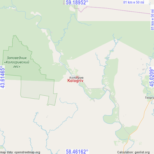
Kologriv GPS coordinates[2]
58° 49' 38.928" North, 44° 19' 3.972" East
| Map corner | latitude | longitude |
|---|---|---|
| Upper-left | 59.18952°, | 43.61465° |
| Center: | 58.82748°, | 44.31777° |
| Lower-right: | 58.46162°, | 45.0209° |
| Map W x H: | 80.9×80.9 km | = 50.3×50.3mi |
| max Lat: | 73.50819° ⇑14% North |
| Kologriv: | 58.82748° |
| min Lat: | ⇓86% South 41.28413° |
| min Long | Kologriv | max Long |
| -179.12198° | 44.31777° | 179.35046° |
| W 48%⇐ | ⇒52% E |
Elevation
Elevation of Kologriv is 137 m = 449 ft, and this is 65.6 m = 215 ft below average elevation for this country.
| Max E: |
2518 m = 8261 ft | 53.6% |
| Avg. | 202.6 m = 665 ft | |
| Kologriv | 137 m = 449 ft | |
Min E: |
-28 m = -92 ft | 46.4% |
See also: Russia elevation on elevation.city.
Geographical zone
Kologriv is located in North temperate zone (between Tropic of Cancer and the Arctic Circle). Distance of this North polar circle is 860.2 km =534.5 mi to North.| Distance of | km | miles | from Kologriv |
|---|---|---|---|
| North Pole | 3466.1 | 2153.7 | to North |
| Arctic Circle | 860.2 | 534.5 | to North |
| Tropic Cancer | 3935.1 | 2445.2 | to South |
| Equator | 6541 | 4064.4 | to South |


Nearby cities:
15 places around Kologriv: (largest is in red/bold)
• Antropovo
89.7 km =55.7 mi,  237°
237°
• Chukhloma
94.5 km =58.7 mi,  265°
265°
• Galich
124.6 km =77.4 mi,  246°
246°
• Georgiyevskoye
42.1 km =26.2 mi,  104°
104°
• Imeni Babushkina
123.5 km =76.7 mi,  326°
326°
• Makar’yev
109 km =67.7 mi,  195°
195°
• Manturovo
61.2 km =38 mi,  154°
154°
• Neya
64.5 km =40.1 mi, 203°
• Nikol’sk
102 km =63.4 mi,  39°
39°
• Parfen’yevo
65 km =40.4 mi,  234°
234°
• Pavino
109.3 km =67.9 mi,  73°
73°
• Pyshchug
80.5 km =50 mi,  85°
85°
• Shar’ya
86.1 km =53.5 mi,  126°
126°
• Soligalich
119.9 km =74.5 mi,  283°
283°
• Vetluzhskiy
82.4 km =51.2 mi, 126°
Sources, notices
• [Note1] Compared only with cities in Russia existing in our database
• [Src1] Map data: © OpenStreetMap contributors (CC-BY-SA)
• [Src2] Other city data from geonames.org with taken over terms of usage.
• [Src3] Geographical zone / Annual Mean Temperature by Robert A. Rohde @ Wikipedia
