Kolchanovo geodata
Kolchanovo (Leningradskaya Oblast') is a populated place; located in Russia in Europe/Moscow (GMT+3) time zone. With population of 2,802 people, there are 3859 cities with bigger population in this country. Compared to other cities in Russia, 90.5% of cities are located further ↓South; 92.5% of cities are located further →East and 89.8% of cities have higher elevation than Kolchanovo. Note1


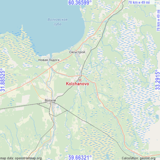
Kolchanovo GPS coordinates[2]
60° 0' 59.292" North, 32° 35' 18.132" East
| Map corner | latitude | longitude |
|---|---|---|
| Upper-left | 60.36599°, | 31.88525° |
| Center: | 60.01647°, | 32.58837° |
| Lower-right: | 59.66321°, | 33.2915° |
| Map W x H: | 78.1×78.1 km | = 48.5×48.5mi |
| max Lat: | 73.50819° ⇑9.5% North |
| Kolchanovo: | 60.01647° |
| min Lat: | ⇓90.5% South 41.28413° |
| min Long | Kolchanovo | max Long |
| -179.12198° | 32.58837° | 179.35046° |
| W 7.5%⇐ | ⇒92.5% E |
Elevation
Elevation of Kolchanovo is 29 m = 95 ft, and this is 173.6 m = 570 ft below average elevation for this country.
| Max E: |
2518 m = 8261 ft | 89.8% |
| Avg. | 202.6 m = 665 ft | |
| Kolchanovo | 29 m = 95 ft | |
Min E: |
-28 m = -92 ft | 10.2% |
See also: Russia elevation on elevation.city.
Geographical zone
Kolchanovo is located in North temperate zone (between Tropic of Cancer and the Arctic Circle). Distance of this North polar circle is 728 km =452.4 mi to North.| Distance of | km | miles | from Kolchanovo |
|---|---|---|---|
| North Pole | 3333.9 | 2071.6 | to North |
| Arctic Circle | 728 | 452.4 | to North |
| Tropic Cancer | 4067.3 | 2527.3 | to South |
| Equator | 6673.2 | 4146.5 | to South |


Nearby cities:
15 places around Kolchanovo: (largest is in red/bold)
• Budogoshch’
82 km =51 mi,  184°
184°
• Imeni Morozova
86.3 km =53.6 mi,  266°
266°
• Issad
14.7 km =9.1 mi,  292°
292°
• Kholm
84.7 km =52.6 mi,  169°
169°
• Khvalovo
11.3 km =7 mi,  132°
132°
• Kirishi
70.9 km =44.1 mi,  206°
206°
• Novaya Ladoga
18.6 km =11.6 mi,  301°
301°
• Pasha
49.1 km =30.5 mi,  30°
30°
• Priladozhskiy
64.3 km =40 mi,  253°
253°
• Shlissel’burg
86.6 km =53.8 mi,  264°
264°
• Sinyavino
85.3 km =53 mi, 261°
• Staraya Ladoga
16.5 km =10.3 mi, 263°
• Syas’stroy
13.4 km =8.3 mi,  355°
355°
• Tikhvin
66.9 km =41.6 mi, 128°
• Volkhov
17.2 km =10.7 mi,  234°
234°
Sources, notices
• [Note1] Compared only with cities in Russia existing in our database
• [Src1] Map data: © OpenStreetMap contributors (CC-BY-SA)
• [Src2] Other city data from geonames.org with taken over terms of usage.
• [Src3] Geographical zone / Annual Mean Temperature by Robert A. Rohde @ Wikipedia
