Issad geodata
Issad (Leningradskaya Oblast') is a populated place; located in Russia in Europe/Moscow (GMT+3) time zone. With population of 1,100 people, there are 4575 cities with bigger population in this country. Compared to other cities in Russia, 90.8% of cities are located further ↓South; 93% of cities are located further →East and 94% of cities have higher elevation than Issad. Note1


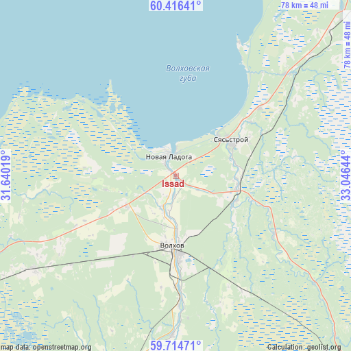
Issad GPS coordinates[2]
60° 4' 2.748" North, 32° 20' 35.916" East
| Map corner | latitude | longitude |
|---|---|---|
| Upper-left | 60.41641°, | 31.64019° |
| Center: | 60.06743°, | 32.34331° |
| Lower-right: | 59.71471°, | 33.04644° |
| Map W x H: | 78×78 km | = 48.5×48.5mi |
| max Lat: | 73.50819° ⇑9.2% North |
| Issad: | 60.06743° |
| min Lat: | ⇓90.8% South 41.28413° |
| min Long | Issad | max Long |
| -179.12198° | 32.34331° | 179.35046° |
| W 7%⇐ | ⇒93% E |
Elevation
Elevation of Issad is 15 m = 49 ft, and this is 187.6 m = 615 ft below average elevation for this country.
| Max E: |
2518 m = 8261 ft | 94% |
| Avg. | 202.6 m = 665 ft | |
| Issad | 15 m = 49 ft | |
Min E: |
-28 m = -92 ft | 6% |
See also: Russia elevation on elevation.city.
Geographical zone
Issad is located in North temperate zone (between Tropic of Cancer and the Arctic Circle). Distance of this North polar circle is 722.3 km =448.8 mi to North.| Distance of | km | miles | from Issad |
|---|---|---|---|
| North Pole | 3328.2 | 2068 | to North |
| Arctic Circle | 722.3 | 448.8 | to North |
| Tropic Cancer | 4073 | 2530.8 | to South |
| Equator | 6678.9 | 4150.1 | to South |


Nearby cities:
15 places around Issad: (largest is in red/bold)
• Borisova Griva
75.8 km =47.1 mi,  271°
271°
• Imeni Morozova
73.3 km =45.5 mi,  261°
261°
• Khvalovo
25.6 km =15.9 mi,  121°
121°
• Kirishi
71.3 km =44.3 mi,  194°
194°
• Kirovsk
77.8 km =48.3 mi,  254°
254°
• Kolchanovo
14.7 km =9.1 mi,  112°
112°
• Mga
79.4 km =49.3 mi,  243°
243°
• Novaya Ladoga
4.5 km =2.8 mi,  329°
329°
• Pasha
53.1 km =33 mi,  46°
46°
• Priladozhskiy
53.6 km =33.3 mi, 243°
• Shlissel’burg
73.7 km =45.8 mi, 259°
• Sinyavino
72.9 km =45.3 mi, 255°
• Staraya Ladoga
8.1 km =5 mi,  199°
199°
• Syas’stroy
14.7 km =9.1 mi,  58°
58°
• Volkhov
15.8 km =9.8 mi,  181°
181°
Sources, notices
• [Note1] Compared only with cities in Russia existing in our database
• [Src1] Map data: © OpenStreetMap contributors (CC-BY-SA)
• [Src2] Other city data from geonames.org with taken over terms of usage.
• [Src3] Geographical zone / Annual Mean Temperature by Robert A. Rohde @ Wikipedia
