Khvalovo geodata
Khvalovo (Leningradskaya Oblast') is a populated place; located in Russia in Europe/Moscow (GMT+3) time zone. With population of 1,514 people, there are 4367 cities with bigger population in this country. Compared to other cities in Russia, 89.9% of cities are located further ↓South; 92.4% of cities are located further →East and 88.5% of cities have higher elevation than Khvalovo. Note1


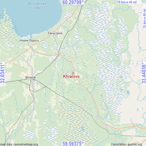
Khvalovo GPS coordinates[2]
59° 56' 51.864" North, 32° 44' 14.028" East
| Map corner | latitude | longitude |
|---|---|---|
| Upper-left | 60.29799°, | 32.03411° |
| Center: | 59.94774°, | 32.73723° |
| Lower-right: | 59.59375°, | 33.44036° |
| Map W x H: | 78.3×78.3 km | = 48.7×48.7mi |
| max Lat: | 73.50819° ⇑10.1% North |
| Khvalovo: | 59.94774° |
| min Lat: | ⇓89.9% South 41.28413° |
| min Long | Khvalovo | max Long |
| -179.12198° | 32.73723° | 179.35046° |
| W 7.6%⇐ | ⇒92.4% E |
Elevation
Elevation of Khvalovo is 34 m = 112 ft, and this is 168.6 m = 553 ft below average elevation for this country.
| Max E: |
2518 m = 8261 ft | 88.5% |
| Avg. | 202.6 m = 665 ft | |
| Khvalovo | 34 m = 112 ft | |
Min E: |
-28 m = -92 ft | 11.5% |
See also: Russia elevation on elevation.city.
Geographical zone
Khvalovo is located in North temperate zone (between Tropic of Cancer and the Arctic Circle). Distance of this North polar circle is 735.6 km =457.1 mi to North.| Distance of | km | miles | from Khvalovo |
|---|---|---|---|
| North Pole | 3341.5 | 2076.3 | to North |
| Arctic Circle | 735.6 | 457.1 | to North |
| Tropic Cancer | 4059.6 | 2522.5 | to South |
| Equator | 6665.6 | 4141.8 | to South |


Nearby cities:
15 places around Khvalovo: (largest is in red/bold)
• Boksitogorsk
81.6 km =50.7 mi,  130°
130°
• Budogoshch’
75.6 km =47 mi,  191°
191°
• Issad
25.6 km =15.9 mi,  301°
301°
• Kholm
76 km =47.2 mi,  175°
175°
• Kirishi
68.7 km =42.7 mi,  215°
215°
• Kolchanovo
11.3 km =7 mi,  312°
312°
• Novaya Ladoga
29.7 km =18.5 mi, 305°
• Pasha
52.6 km =32.7 mi,  18°
18°
• Pikalëvo
93.2 km =57.9 mi,  120°
120°
• Priladozhskiy
70.8 km =44 mi,  261°
261°
• Sinyavino
92.9 km =57.7 mi,  267°
267°
• Staraya Ladoga
25.3 km =15.7 mi,  282°
282°
• Syas’stroy
23 km =14.3 mi,  336°
336°
• Tikhvin
55.6 km =34.5 mi, 127°
• Volkhov
22.4 km =13.9 mi, 263°
Sources, notices
• [Note1] Compared only with cities in Russia existing in our database
• [Src1] Map data: © OpenStreetMap contributors (CC-BY-SA)
• [Src2] Other city data from geonames.org with taken over terms of usage.
• [Src3] Geographical zone / Annual Mean Temperature by Robert A. Rohde @ Wikipedia
