Kinel’-Cherkassy geodata
Kinel’-Cherkassy (Samara Oblast) is a populated place; located in Russia in Europe/Samara (GMT+4) time zone. With population of 18,393 people, there are 938 cities with bigger population in this country. Compared to other cities in Russia, 58.9% of cities are located further ↑North; 63.4% of cities are located further ←West and 85.1% of cities have higher elevation than Kinel’-Cherkassy. Note1


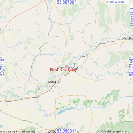
Kinel’-Cherkassy GPS coordinates[2]
53° 28' 14.16" North, 51° 28' 27.516" East
| Map corner | latitude | longitude |
|---|---|---|
| Upper-left | 53.88706°, | 50.77119° |
| Center: | 53.4706°, | 51.47431° |
| Lower-right: | 53.05001°, | 52.17744° |
| Map W x H: | 93.1×93.1 km | = 57.8×57.8mi |
| max Lat: | 73.50819° ⇑58.9% North |
| Kinel’-Cherkassy: | 53.4706° |
| min Lat: | ⇓41.1% South 41.28413° |
| min Long | Kinel’-Cherka | max Long |
| -179.12198° | 51.47431° | 179.35046° |
| W 63.4%⇐ | ⇒36.6% E |
Elevation
Elevation of Kinel’-Cherkassy is 47 m = 154 ft, and this is 155.6 m = 510 ft below average elevation for this country.
| Max E: |
2518 m = 8261 ft | 85.1% |
| Avg. | 202.6 m = 665 ft | |
| Kinel’-Cherkassy | 47 m = 154 ft | |
Min E: |
-28 m = -92 ft | 14.9% |
See also: Russia elevation on elevation.city.
Geographical zone
Kinel’-Cherkassy is located in North temperate zone (between Tropic of Cancer and the Arctic Circle). Distance of this North polar circle is 1455.8 km =904.6 mi to North.| Distance of | km | miles | from Kinel’-Cherkassy |
|---|---|---|---|
| North Pole | 4061.7 | 2523.8 | to North |
| Arctic Circle | 1455.8 | 904.6 | to North |
| Tropic Cancer | 3339.5 | 2075.1 | to South |
| Equator | 5945.4 | 3694.3 | to South |


Nearby cities:
15 places around Kinel’-Cherkassy: (largest is in red/bold)
• Bogatoye
46.6 km =29 mi,  191°
191°
• Borskoye
51.2 km =31.8 mi,  161°
161°
• Buguruslan
67.1 km =41.7 mi,  72°
72°
• Georgiyevka
38.4 km =23.9 mi,  235°
235°
• Kinel’
62.4 km =38.8 mi, 244°
• Koltubanovskiy
69.5 km =43.2 mi,  148°
148°
• Krasnyy Yar
71.6 km =44.5 mi,  272°
272°
• Krotovka
28.9 km =18 mi,  224°
224°
• Otradnyy
13.6 km =8.5 mi, 219°
• Podsolnechnoye
50.8 km =31.6 mi,  134°
134°
• Pokhvistnevo
47.6 km =29.6 mi,  64°
64°
• Sernovodsk
52.3 km =32.5 mi,  344°
344°
• Spiridonovka
69.3 km =43.1 mi,  232°
232°
• Sukhodol
50.8 km =31.6 mi, 340°
• Surgut
53.6 km =33.3 mi, 340°
Sources, notices
• [Note1] Compared only with cities in Russia existing in our database
• [Src1] Map data: © OpenStreetMap contributors (CC-BY-SA)
• [Src2] Other city data from geonames.org with taken over terms of usage.
• [Src3] Geographical zone / Annual Mean Temperature by Robert A. Rohde @ Wikipedia
