Khrenovoye geodata
Khrenovoye (Voronezj) is a populated place; located in Russia in Europe/Moscow (GMT+3) time zone. With population of 5,476 people, there are 2447 cities with bigger population in this country. Compared to other cities in Russia, 74.4% of cities are located further ↑North; 66.1% of cities are located further →East and 54.2% of cities have higher elevation than Khrenovoye. Note1


Khrenovoye GPS coordinates[2]
51° 7' 12" North, 40° 17' 20.004" East
| Map corner | latitude | longitude |
|---|---|---|
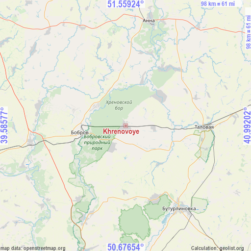
| Upper-left | 51.55924°, | 39.58577° |
| Center: | 51.12°, | 40.28889° |
| Lower-right: | 50.67654°, | 40.99202° |
| Map W x H: | 98.1×98.1 km | = 61×61mi |
| max Lat: | 73.50819° ⇑74.4% North |
| Khrenovoye: | 51.12° |
| min Lat: | ⇓25.6% South 41.28413° |
| min Long | Khrenovoye | max Long |
| -179.12198° | 40.28889° | 179.35046° |
| W 33.9%⇐ | ⇒66.1% E |
Elevation
Elevation of Khrenovoye is 136 m = 446 ft, and this is 66.6 m = 219 ft below average elevation for this country.
| Max E: |
2518 m = 8261 ft | 54.2% |
| Avg. | 202.6 m = 665 ft | |
| Khrenovoye | 136 m = 446 ft | |
Min E: |
-28 m = -92 ft | 45.8% |
See also: Russia elevation on elevation.city.
Geographical zone
Khrenovoye is located in North temperate zone (between Tropic of Cancer and the Arctic Circle). Distance of this North polar circle is 1717.2 km =1067 mi to North.| Distance of | km | miles | from Khrenovoye |
|---|---|---|---|
| North Pole | 4323.1 | 2686.2 | to North |
| Arctic Circle | 1717.2 | 1067 | to North |
| Tropic Cancer | 3078.1 | 1912.6 | to South |
| Equator | 5684 | 3531.9 | to South |


Nearby cities:
15 places around Khrenovoye: (largest is in red/bold)
• Abramovka
51.6 km =32.1 mi,  81°
81°
• Anna
41.7 km =25.9 mi,  13°
13°
• Bobrov
18 km =11.2 mi,  261°
261°
• Buturlinovka
39.8 km =24.7 mi,  145°
145°
• Imeni Pervogo Maya
55.1 km =34.2 mi,  242°
242°
• Kozlovka
30.9 km =19.2 mi,  157°
157°
• Liski
56.1 km =34.9 mi,  254°
254°
• Losevo
52.2 km =32.4 mi,  199°
199°
• Nizhniy Kislyay
31.2 km =19.4 mi, 195°
• Novaya Chigla
17.5 km =10.9 mi,  48°
48°
• Sadovoye
48 km =29.8 mi,  17°
17°
• Sloboda
2.6 km =1.6 mi, 20°
• Sredniy Ikorets
37.5 km =23.3 mi, 261°
• Talovaya
30.8 km =19.1 mi,  91°
91°
• Verkhnyaya Tishanka
28.3 km =17.6 mi,  36°
36°
Sources, notices
• [Note1] Compared only with cities in Russia existing in our database
• [Src1] Map data: © OpenStreetMap contributors (CC-BY-SA)
• [Src2] Other city data from geonames.org with taken over terms of usage.
• [Src3] Geographical zone / Annual Mean Temperature by Robert A. Rohde @ Wikipedia
