Kargopol’ geodata
Kargopol’ (Arkhangelskaya) is a populated place; located in Russia in Europe/Moscow (GMT+3) time zone. With population of 10,966 people, there are 1378 cities with bigger population in this country. Compared to other cities in Russia, 94% of cities are located further ↓South; 72.3% of cities are located further →East and 61.4% of cities have higher elevation than Kargopol’. Note1


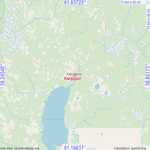
Kargopol’ GPS coordinates[2]
61° 30' 12.924" North, 38° 56' 54.96" East
| Map corner | latitude | longitude |
|---|---|---|
| Upper-left | 61.83725°, | 38.24548° |
| Center: | 61.50359°, | 38.9486° |
| Lower-right: | 61.16631°, | 39.65173° |
| Map W x H: | 74.6×74.6 km | = 46.4×46.4mi |
| max Lat: | 73.50819° ⇑6% North |
| Kargopol’: | 61.50359° |
| min Lat: | ⇓94% South 41.28413° |
| min Long | Kargopol’ | max Long |
| -179.12198° | 38.9486° | 179.35046° |
| W 27.7%⇐ | ⇒72.3% E |
Elevation
Elevation of Kargopol’ is 121 m = 397 ft, and this is 81.6 m = 268 ft below average elevation for this country.
| Max E: |
2518 m = 8261 ft | 61.4% |
| Avg. | 202.6 m = 665 ft | |
| Kargopol’ | 121 m = 397 ft | |
Min E: |
-28 m = -92 ft | 38.6% |
See also: Russia elevation on elevation.city.
Geographical zone
Kargopol’ is located in North temperate zone (between Tropic of Cancer and the Arctic Circle). Distance of this North polar circle is 562.6 km =349.6 mi to North.| Distance of | km | miles | from Kargopol’ |
|---|---|---|---|
| North Pole | 3168.5 | 1968.8 | to North |
| Arctic Circle | 562.6 | 349.6 | to North |
| Tropic Cancer | 4232.6 | 2630 | to South |
| Equator | 6838.6 | 4249.3 | to South |


Nearby cities:
15 places around Kargopol’: (largest is in red/bold)
• Arkhangelo-Shelokhovskaya
46.6 km =29 mi,  9°
9°
• Konosha
91.5 km =56.9 mi,  130°
130°
• Konëvo
71.2 km =44.2 mi,  16°
16°
• Nyandoma
68.7 km =42.7 mi,  74°
74°
• Oksovskiy
132.2 km =82.1 mi, 21°
• Podyuga
111.9 km =69.5 mi,  113°
113°
• Pudozh
132.1 km =82.1 mi,  284°
284°
• Shalakusha
105.4 km =65.5 mi,  40°
40°
• Shelokhovskaya
46 km =28.6 mi, 10°
• Solginskiy
137.5 km =85.4 mi, 111°
• Ust’-Shonosha
133.5 km =83 mi, 106°
• Voloshka
63.5 km =39.5 mi, 107°
• Vozhega
133.6 km =83 mi,  149°
149°
• Vytegra
144.7 km =89.9 mi,  247°
247°
• Yertsevo
99.5 km =61.8 mi,  142°
142°
Sources, notices
• [Note1] Compared only with cities in Russia existing in our database
• [Src1] Map data: © OpenStreetMap contributors (CC-BY-SA)
• [Src2] Other city data from geonames.org with taken over terms of usage.
• [Src3] Geographical zone / Annual Mean Temperature by Robert A. Rohde @ Wikipedia
