Arkhangelo-Shelokhovskaya geodata
Arkhangelo-Shelokhovskaya (Arkhangelskaya) is a populated place; located in Russia in Europe/Moscow (GMT+3) time zone. With population of 521 people, there are 4951 cities with bigger population in this country. Compared to other cities in Russia, 94.7% of cities are located further ↓South; 71.6% of cities are located further →East and 69.6% of cities have higher elevation than Arkhangelo-Shelokhovskaya. Note1
Current local time in Arkhangelo-Shelokhovskaya:
04:45 PM, MondayDifference from your time zone: hours


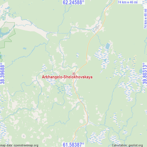
Arkhangelo-Shelokhovskaya GPS coordinates[2]
61° 55' 0.012" North, 39° 6' 0" East
| Map corner | latitude | longitude |
|---|---|---|
| Upper-left | 62.24588°, | 38.39688° |
| Center: | 61.91667°, | 39.1° |
| Lower-right: | 61.58387°, | 39.80313° |
| Map W x H: | 73.6×73.6 km | = 45.7×45.7mi |
| max Lat: | 73.50819° ⇑5.3% North |
| Arkhangelo-Shelokhovskaya: | 61.91667° |
| min Lat: | ⇓94.7% South 41.28413° |
| min Long | Arkhangelo-Shel | max Long |
| -179.12198° | 39.1° | 179.35046° |
| W 28.4%⇐ | ⇒71.6% E |
Elevation
Elevation of Arkhangelo-Shelokhovskaya is 103 m = 338 ft, and this is 99.6 m = 327 ft below average elevation for this country.
| Max E: |
2518 m = 8261 ft | 69.6% |
| Avg. | 202.6 m = 665 ft | |
| Arkhangelo-Shelokhovskaya | 103 m = 338 ft | |
Min E: |
-28 m = -92 ft | 30.4% |
See also: Russia elevation on elevation.city.
Geographical zone
Arkhangelo-Shelokhovskaya is located in North temperate zone (between Tropic of Cancer and the Arctic Circle). Distance of this North polar circle is 516.7 km =321.1 mi to North.| Distance of | km | miles | from Arkhangelo-Shelokhovskaya |
|---|---|---|---|
| North Pole | 3122.6 | 1940.3 | to North |
| Arctic Circle | 516.7 | 321.1 | to North |
| Tropic Cancer | 4278.6 | 2658.6 | to South |
| Equator | 6884.5 | 4277.8 | to South |


Nearby cities:
15 places around Arkhangelo-Shelokhovskaya: (largest is in red/bold)
• Kargopol’
46.6 km =29 mi,  189°
189°
• Konosha
121.6 km =75.6 mi,  149°
149°
• Konëvo
25.4 km =15.8 mi,  28°
28°
• Mirnyy
113.8 km =70.7 mi, 34°
• Nyandoma
64.3 km =40 mi,  115°
115°
• Oksovskiy
87.1 km =54.1 mi, 28°
• Plesetsk
107.4 km =66.7 mi, 34°
• Podyuga
130.8 km =81.3 mi,  134°
134°
• Pudozh
135.5 km =84.2 mi,  264°
264°
• Puksoozero
108.1 km =67.2 mi,  46°
46°
• Shalakusha
69.2 km =43 mi,  60°
60°
• Shelokhovskaya
0.7 km =0.4 mi,  165°
165°
• Voloshka
83.4 km =51.8 mi,  141°
141°
• Yemtsa
143.3 km =89 mi, 26°
• Yertsevo
135.2 km =84 mi,  157°
157°
Sources, notices
• [Note1] Compared only with cities in Russia existing in our database
• [Src1] Map data: © OpenStreetMap contributors (CC-BY-SA)
• [Src2] Other city data from geonames.org with taken over terms of usage.
• [Src3] Geographical zone / Annual Mean Temperature by Robert A. Rohde @ Wikipedia
