Konëvo geodata
Konëvo (Arkhangelskaya) is a populated place; located in Russia in Europe/Moscow (GMT+3) time zone. With population of 2,951 people, there are 3806 cities with bigger population in this country. Compared to other cities in Russia, 95.1% of cities are located further ↓South; 70.8% of cities are located further →East and 67.7% of cities have higher elevation than Konëvo. Note1


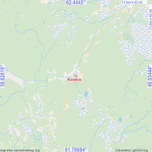
Konëvo GPS coordinates[2]
62° 7' 2.82" North, 39° 19' 52.716" East
| Map corner | latitude | longitude |
|---|---|---|
| Upper-left | 62.4445°, | 38.62819° |
| Center: | 62.11745°, | 39.33131° |
| Lower-right: | 61.78684°, | 40.03444° |
| Map W x H: | 73.1×73.1 km | = 45.4×45.4mi |
| max Lat: | 73.50819° ⇑4.9% North |
| Konëvo: | 62.11745° |
| min Lat: | ⇓95.1% South 41.28413° |
| min Long | Konëvo | max Long |
| -179.12198° | 39.33131° | 179.35046° |
| W 29.2%⇐ | ⇒70.8% E |
Elevation
Elevation of Konëvo is 108 m = 354 ft, and this is 94.6 m = 310 ft below average elevation for this country.
| Max E: |
2518 m = 8261 ft | 67.7% |
| Avg. | 202.6 m = 665 ft | |
| Konëvo | 108 m = 354 ft | |
Min E: |
-28 m = -92 ft | 32.3% |
See also: Russia elevation on elevation.city.
Geographical zone
Konëvo is located in North temperate zone (between Tropic of Cancer and the Arctic Circle). Distance of this North polar circle is 494.4 km =307.2 mi to North.| Distance of | km | miles | from Konëvo |
|---|---|---|---|
| North Pole | 3100.2 | 1926.4 | to North |
| Arctic Circle | 494.4 | 307.2 | to North |
| Tropic Cancer | 4300.9 | 2672.5 | to South |
| Equator | 6906.8 | 4291.7 | to South |


Nearby cities:
15 places around Konëvo: (largest is in red/bold)
• Arkhangelo-Shelokhovskaya
25.4 km =15.8 mi,  208°
208°
• Kargopol’
71.2 km =44.2 mi,  196°
196°
• Konosha
136.3 km =84.7 mi,  158°
158°
• Mirnyy
88.6 km =55.1 mi,  35°
35°
• Nyandoma
67.8 km =42.1 mi,  137°
137°
• Oksovskiy
61.7 km =38.3 mi,  28°
28°
• Plesetsk
82.2 km =51.1 mi, 36°
• Podyuga
139.6 km =86.7 mi, 144°
• Pudozh
150.6 km =93.6 mi,  256°
256°
• Puksoozero
84.2 km =52.3 mi,  51°
51°
• Shalakusha
49.4 km =30.7 mi,  76°
76°
• Shelokhovskaya
25.9 km =16.1 mi, 207°
• Ust’-Shonosha
150.9 km =93.8 mi, 135°
• Voloshka
96 km =59.7 mi, 155°
• Yemtsa
118 km =73.3 mi, 25°
Sources, notices
• [Note1] Compared only with cities in Russia existing in our database
• [Src1] Map data: © OpenStreetMap contributors (CC-BY-SA)
• [Src2] Other city data from geonames.org with taken over terms of usage.
• [Src3] Geographical zone / Annual Mean Temperature by Robert A. Rohde @ Wikipedia
