Nyandoma geodata
Nyandoma (Arkhangelskaya) is a populated place; located in Russia in Europe/Moscow (GMT+3) time zone. With population of 22,179 people, there are 808 cities with bigger population in this country. Compared to other cities in Russia, 94.2% of cities are located further ↓South; 66.5% of cities are located further →East and 75.7% of cities have lower elevation than Nyandoma. Note1


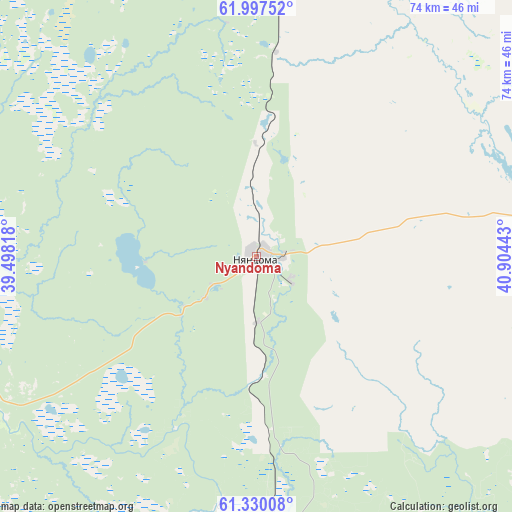
Nyandoma GPS coordinates[2]
61° 39' 56.16" North, 40° 12' 4.68" East
| Map corner | latitude | longitude |
|---|---|---|
| Upper-left | 61.99752°, | 39.49818° |
| Center: | 61.6656°, | 40.2013° |
| Lower-right: | 61.33008°, | 40.90443° |
| Map W x H: | 74.2×74.2 km | = 46.1×46.1mi |
| max Lat: | 73.50819° ⇑5.8% North |
| Nyandoma: | 61.6656° |
| min Lat: | ⇓94.2% South 41.28413° |
| min Long | Nyandoma | max Long |
| -179.12198° | 40.2013° | 179.35046° |
| W 33.5%⇐ | ⇒66.5% E |
Elevation
Elevation of Nyandoma is 220 m = 722 ft, and this is 17.4 m = 57 ft above average elevation for this country.
| Max E: |
2518 m = 8261 ft | 24.3% |
| Nyandoma | 220 m 722 ft | |
| Avg. | 202.6 m = 665 ft | |
Min E: |
-28 m = -92 ft | 75.7% |
See also: Russia elevation on elevation.city.
Geographical zone
Nyandoma is located in North temperate zone (between Tropic of Cancer and the Arctic Circle). Distance of this North polar circle is 544.6 km =338.4 mi to North.| Distance of | km | miles | from Nyandoma |
|---|---|---|---|
| North Pole | 3150.5 | 1957.6 | to North |
| Arctic Circle | 544.6 | 338.4 | to North |
| Tropic Cancer | 4250.7 | 2641.3 | to South |
| Equator | 6856.6 | 4260.5 | to South |


Nearby cities:
15 places around Nyandoma: (largest is in red/bold)
• Arkhangelo-Shelokhovskaya
64.3 km =40 mi,  295°
295°
• Kargopol’
68.7 km =42.7 mi,  254°
254°
• Konosha
77 km =47.8 mi,  177°
177°
• Konëvo
67.8 km =42.1 mi,  317°
317°
• Oksovskiy
105.8 km =65.7 mi,  351°
351°
• Plesetsk
116 km =72.1 mi,  2°
2°
• Podyuga
72.6 km =45.1 mi,  150°
150°
• Puksoozero
105 km =65.2 mi,  11°
11°
• Shalakusha
62.2 km =38.6 mi, 2°
• Shelokhovskaya
63.8 km =39.6 mi, 295°
• Solginskiy
91.6 km =56.9 mi,  138°
138°
• Ust’-Shonosha
83.3 km =51.8 mi,  133°
133°
• Vel’sk
120.8 km =75.1 mi,  123°
123°
• Voloshka
37.7 km =23.4 mi,  189°
189°
• Yertsevo
96.8 km =60.1 mi, 183°
Sources, notices
• [Note1] Compared only with cities in Russia existing in our database
• [Src1] Map data: © OpenStreetMap contributors (CC-BY-SA)
• [Src2] Other city data from geonames.org with taken over terms of usage.
• [Src3] Geographical zone / Annual Mean Temperature by Robert A. Rohde @ Wikipedia
