Bakaly geodata
Bakaly (Bashkortostan Republic) is a populated place; located in Russia in Asia/Yekaterinburg (GMT+5) time zone. With population of 9,532 people, there are 1586 cities with bigger population in this country. Compared to other cities in Russia, 55.1% of cities are located further ↓South; 65.5% of cities are located further ←West and 67.7% of cities have higher elevation than Bakaly. Note1


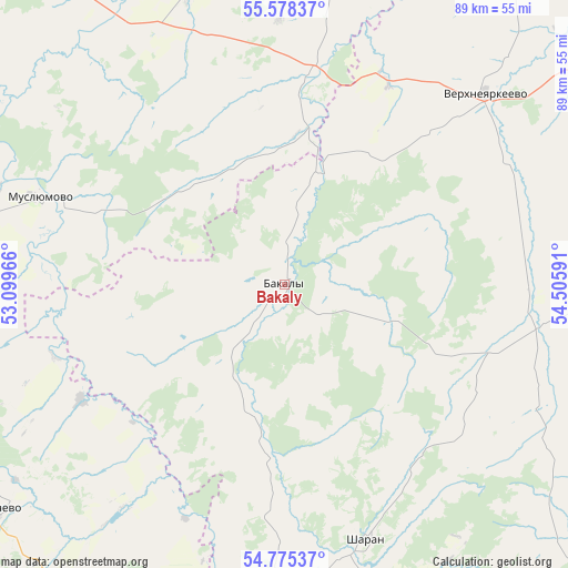
Bakaly GPS coordinates[2]
55° 10' 44.004" North, 53° 48' 10.008" East
| Map corner | latitude | longitude |
|---|---|---|
| Upper-left | 55.57837°, | 53.09966° |
| Center: | 55.17889°, | 53.80278° |
| Lower-right: | 54.77537°, | 54.50591° |
| Map W x H: | 89.3×89.3 km | = 55.5×55.5mi |
| max Lat: | 73.50819° ⇑44.9% North |
| Bakaly: | 55.17889° |
| min Lat: | ⇓55.1% South 41.28413° |
| min Long | Bakaly | max Long |
| -179.12198° | 53.80278° | 179.35046° |
| W 65.5%⇐ | ⇒34.5% E |
Elevation
Elevation of Bakaly is 108 m = 354 ft, and this is 94.6 m = 310 ft below average elevation for this country.
| Max E: |
2518 m = 8261 ft | 67.7% |
| Avg. | 202.6 m = 665 ft | |
| Bakaly | 108 m = 354 ft | |
Min E: |
-28 m = -92 ft | 32.3% |
See also: Russia elevation on elevation.city.
Geographical zone
Bakaly is located in North temperate zone (between Tropic of Cancer and the Arctic Circle). Distance of this North polar circle is 1265.9 km =786.6 mi to North.| Distance of | km | miles | from Bakaly |
|---|---|---|---|
| North Pole | 3871.7 | 2405.8 | to North |
| Arctic Circle | 1265.9 | 786.6 | to North |
| Tropic Cancer | 3529.4 | 2193.1 | to South |
| Equator | 6135.3 | 3812.3 | to South |


Nearby cities:
15 places around Bakaly: (largest is in red/bold)
• Aktanysh
62.9 km =39.1 mi,  16°
16°
• Aktyubinskiy
75.5 km =46.9 mi,  237°
237°
• Chekmagush
54.4 km =33.8 mi,  95°
95°
• Dyurtyuli
75.8 km =47.1 mi,  62°
62°
• Dzhalil’
70 km =43.5 mi,  255°
255°
• Kandry
71 km =44.1 mi,  163°
163°
• Menzelinsk
75.3 km =46.8 mi,  324°
324°
• Muslyumovo
41 km =25.5 mi,  289°
289°
• Sarmanovo
77.5 km =48.2 mi,  276°
276°
• Semiletka
55.3 km =34.4 mi,  68°
68°
• Sharan
42.2 km =26.2 mi, 162°
• Subkhankulovo
69.1 km =42.9 mi,  179°
179°
• Tuymazy
63.9 km =39.7 mi,  185°
185°
• Urussu
68.1 km =42.3 mi,  198°
198°
• Verkhneyarkeyevo
44.3 km =27.5 mi,  47°
47°
Sources, notices
• [Note1] Compared only with cities in Russia existing in our database
• [Src1] Map data: © OpenStreetMap contributors (CC-BY-SA)
• [Src2] Other city data from geonames.org with taken over terms of usage.
• [Src3] Geographical zone / Annual Mean Temperature by Robert A. Rohde @ Wikipedia
