Izmalkovo geodata
Izmalkovo (Lipetsk Oblast) is a populated place; located in Russia in Europe/Moscow (GMT+3) time zone. With population of 4,072 people, there are 3070 cities with bigger population in this country. Compared to other cities in Russia, 64.9% of cities are located further ↑North; 77.5% of cities are located further →East and 79.6% of cities have lower elevation than Izmalkovo. Note1


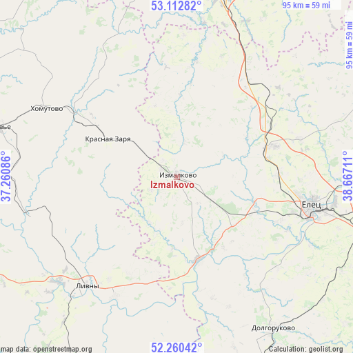
Izmalkovo GPS coordinates[2]
52° 41' 19.32" North, 37° 57' 50.328" East
| Map corner | latitude | longitude |
|---|---|---|
| Upper-left | 53.11282°, | 37.26086° |
| Center: | 52.6887°, | 37.96398° |
| Lower-right: | 52.26042°, | 38.66711° |
| Map W x H: | 94.8×94.8 km | = 58.9×58.9mi |
| max Lat: | 73.50819° ⇑64.9% North |
| Izmalkovo: | 52.6887° |
| min Lat: | ⇓35.1% South 41.28413° |
| min Long | Izmalkovo | max Long |
| -179.12198° | 37.96398° | 179.35046° |
| W 22.5%⇐ | ⇒77.5% E |
Elevation
Elevation of Izmalkovo is 245 m = 804 ft, and this is 42.4 m = 139 ft above average elevation for this country.
| Max E: |
2518 m = 8261 ft | 20.4% |
| Izmalkovo | 245 m 804 ft | |
| Avg. | 202.6 m = 665 ft | |
Min E: |
-28 m = -92 ft | 79.6% |
See also: Russia elevation on elevation.city.
Geographical zone
Izmalkovo is located in North temperate zone (between Tropic of Cancer and the Arctic Circle). Distance of this North polar circle is 1542.7 km =958.6 mi to North.| Distance of | km | miles | from Izmalkovo |
|---|---|---|---|
| North Pole | 4148.6 | 2577.8 | to North |
| Arctic Circle | 1542.7 | 958.6 | to North |
| Tropic Cancer | 3252.5 | 2021 | to South |
| Equator | 5858.4 | 3640.2 | to South |


Nearby cities:
15 places around Izmalkovo: (largest is in red/bold)
• Dolgorukovo
48.5 km =30.1 mi,  147°
147°
• Donskoye
68.6 km =42.6 mi,  96°
96°
• Kazaki
21.5 km =13.4 mi,  109°
109°
• Khomutovo
39.8 km =24.7 mi,  297°
297°
• Krasnaya Zarya
21.7 km =13.5 mi, 298°
• Krasnoye
59.1 km =36.7 mi,  70°
70°
• Livny
37.9 km =23.5 mi,  219°
219°
• Novosil’
69.7 km =43.3 mi, 297°
• Shilovo
68.2 km =42.4 mi,  34°
34°
• Stanovoye
27.8 km =17.3 mi, 72°
• Terbuny
63.8 km =39.6 mi,  160°
160°
• Verkhov’ye
50.5 km =31.4 mi,  285°
285°
• Yefremov
51.9 km =32.2 mi,  10°
10°
• Yelets
37 km =23 mi, 101°
• Zadonsk
73 km =45.4 mi,  117°
117°
Sources, notices
• [Note1] Compared only with cities in Russia existing in our database
• [Src1] Map data: © OpenStreetMap contributors (CC-BY-SA)
• [Src2] Other city data from geonames.org with taken over terms of usage.
• [Src3] Geographical zone / Annual Mean Temperature by Robert A. Rohde @ Wikipedia
