Verkhov’ye geodata
Verkhov’ye (Orel Oblast) is a populated place; located in Russia in Europe/Moscow (GMT+3) time zone. With population of 8,100 people, there are 1782 cities with bigger population in this country. Compared to other cities in Russia, 64% of cities are located further ↑North; 83.8% of cities are located further →East and 81.3% of cities have lower elevation than Verkhov’ye. Note1


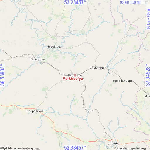
Verkhov’ye GPS coordinates[2]
52° 48' 41.94" North, 37° 14' 31.74" East
| Map corner | latitude | longitude |
|---|---|---|
| Upper-left | 53.23457°, | 36.53903° |
| Center: | 52.81165°, | 37.24215° |
| Lower-right: | 52.38457°, | 37.94528° |
| Map W x H: | 94.5×94.5 km | = 58.7×58.7mi |
| max Lat: | 73.50819° ⇑64% North |
| Verkhov’ye: | 52.81165° |
| min Lat: | ⇓36% South 41.28413° |
| min Long | Verkhov’ye | max Long |
| -179.12198° | 37.24215° | 179.35046° |
| W 16.2%⇐ | ⇒83.8% E |
Elevation
Elevation of Verkhov’ye is 263 m = 863 ft, and this is 60.4 m = 198 ft above average elevation for this country.
| Max E: |
2518 m = 8261 ft | 18.7% |
| Verkhov’ye | 263 m 863 ft | |
| Avg. | 202.6 m = 665 ft | |
Min E: |
-28 m = -92 ft | 81.3% |
See also: Russia elevation on elevation.city.
Geographical zone
Verkhov’ye is located in North temperate zone (between Tropic of Cancer and the Arctic Circle). Distance of this North polar circle is 1529.1 km =950.1 mi to North.| Distance of | km | miles | from Verkhov’ye |
|---|---|---|---|
| North Pole | 4135 | 2569.4 | to North |
| Arctic Circle | 1529.1 | 950.1 | to North |
| Tropic Cancer | 3266.2 | 2029.5 | to South |
| Equator | 5872.1 | 3648.8 | to South |


Nearby cities:
15 places around Verkhov’ye: (largest is in red/bold)
• Glazunovka
71.2 km =44.2 mi,  240°
240°
• Izmalkovo
50.5 km =31.4 mi,  105°
105°
• Kazaki
71.9 km =44.7 mi, 106°
• Khomutovo
14 km =8.7 mi,  70°
70°
• Kolpny
66.3 km =41.2 mi,  192°
192°
• Korsakovo
51.3 km =31.9 mi,  8°
8°
• Krasnaya Zarya
29.7 km =18.5 mi,  96°
96°
• Livny
49.5 km =30.8 mi,  150°
150°
• Maloarkhangel’sk
67.7 km =42.1 mi,  227°
227°
• Mtsensk
68.3 km =42.4 mi,  319°
319°
• Novosil’
22.5 km =14 mi, 323°
• Pokrovskoye
33.6 km =20.9 mi, 228°
• Yefremov
68.5 km =42.6 mi,  56°
56°
• Zalegoshch’
25.5 km =15.8 mi,  292°
292°
• Zmiyëvka
60.6 km =37.7 mi,  254°
254°
Sources, notices
• [Note1] Compared only with cities in Russia existing in our database
• [Src1] Map data: © OpenStreetMap contributors (CC-BY-SA)
• [Src2] Other city data from geonames.org with taken over terms of usage.
• [Src3] Geographical zone / Annual Mean Temperature by Robert A. Rohde @ Wikipedia
