Glazov geodata
Glazov (Udmurtiya Republic) is a populated place; located in Russia in Europe/Samara (GMT+4) time zone. With population of 100,676 people, there are 210 cities with bigger population in this country. Compared to other cities in Russia, 83.3% of cities are located further ↓South; 64.6% of cities are located further ←West and 52.8% of cities have lower elevation than Glazov. Note1


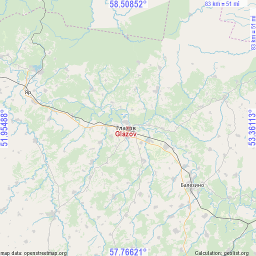
Glazov GPS coordinates[2]
58° 8' 21.48" North, 52° 39' 28.8" East
| Map corner | latitude | longitude |
|---|---|---|
| Upper-left | 58.50852°, | 51.95488° |
| Center: | 58.1393°, | 52.658° |
| Lower-right: | 57.76621°, | 53.36113° |
| Map W x H: | 82.5×82.5 km | = 51.3×51.3mi |
| max Lat: | 73.50819° ⇑16.7% North |
| Glazov: | 58.1393° |
| min Lat: | ⇓83.3% South 41.28413° |
| min Long | Glazov | max Long |
| -179.12198° | 52.658° | 179.35046° |
| W 64.6%⇐ | ⇒35.4% E |
Elevation
Elevation of Glazov is 151 m = 495 ft, and this is 51.6 m = 169 ft below average elevation for this country.
| Max E: |
2518 m = 8261 ft | 47.2% |
| Avg. | 202.6 m = 665 ft | |
| Glazov | 151 m = 495 ft | |
Min E: |
-28 m = -92 ft | 52.8% |
See also: Glazov elevation on elevation.city.
Geographical zone
Glazov is located in North temperate zone (between Tropic of Cancer and the Arctic Circle). Distance of this North polar circle is 936.7 km =582 mi to North.| Distance of | km | miles | from Glazov |
|---|---|---|---|
| North Pole | 3542.6 | 2201.3 | to North |
| Arctic Circle | 936.7 | 582 | to North |
| Tropic Cancer | 3858.6 | 2397.6 | to South |
| Equator | 6464.5 | 4016.9 | to South |


Nearby cities:
15 places around Glazov: (largest is in red/bold)
• Balezino
27.5 km =17.1 mi,  130°
130°
• Belorechensk
73.5 km =45.7 mi,  343°
343°
• Fakel
60.5 km =37.6 mi,  158°
158°
• Falënki
66.9 km =41.6 mi,  291°
291°
• Igra
69.1 km =42.9 mi, 160°
• Kez
67.8 km =42.1 mi,  113°
113°
• Kosino
86.2 km =53.6 mi, 290°
• Krasnogorskoye
49.2 km =30.6 mi,  190°
190°
• Omutninsk
64.9 km =40.3 mi, 335°
• Pudem
34.1 km =21.2 mi,  302°
302°
• Uni
81.3 km =50.5 mi,  237°
237°
• Vostochnyy
76 km =47.2 mi, 341°
• Yar
34.5 km =21.4 mi, 290°
• Yukamenskoye
37.1 km =23.1 mi,  221°
221°
• Yunda
31.8 km =19.8 mi,  153°
153°
Sources, notices
• [Note1] Compared only with cities in Russia existing in our database
• [Src1] Map data: © OpenStreetMap contributors (CC-BY-SA)
• [Src2] Other city data from geonames.org with taken over terms of usage.
• [Src3] Geographical zone / Annual Mean Temperature by Robert A. Rohde @ Wikipedia
