Duvan geodata
Duvan (Bashkortostan Republic) is a populated place; located in Russia in Asia/Yekaterinburg (GMT+5) time zone. With population of 3,710 people, there are 3261 cities with bigger population in this country. Compared to other cities in Russia, 61.4% of cities are located further ↓South; 69.5% of cities are located further ←West and 84.2% of cities have lower elevation than Duvan. Note1


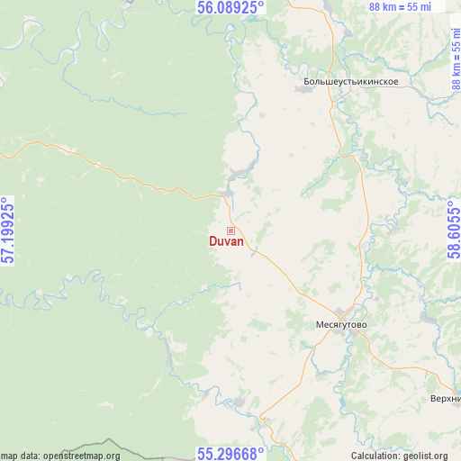
Duvan GPS coordinates[2]
55° 41' 41.892" North, 57° 54' 8.532" East
| Map corner | latitude | longitude |
|---|---|---|
| Upper-left | 56.08925°, | 57.19925° |
| Center: | 55.69497°, | 57.90237° |
| Lower-right: | 55.29668°, | 58.6055° |
| Map W x H: | 88.1×88.1 km | = 54.7×54.7mi |
| max Lat: | 73.50819° ⇑38.6% North |
| Duvan: | 55.69497° |
| min Lat: | ⇓61.4% South 41.28413° |
| min Long | Duvan | max Long |
| -179.12198° | 57.90237° | 179.35046° |
| W 69.5%⇐ | ⇒30.5% E |
Elevation
Elevation of Duvan is 307 m = 1007 ft, and this is 104.4 m = 343 ft above average elevation for this country.
| Max E: |
2518 m = 8261 ft | 15.8% |
| Duvan | 307 m 1007 ft | |
| Avg. | 202.6 m = 665 ft | |
Min E: |
-28 m = -92 ft | 84.2% |
See also: Russia elevation on elevation.city.
Geographical zone
Duvan is located in North temperate zone (between Tropic of Cancer and the Arctic Circle). Distance of this North polar circle is 1208.5 km =750.9 mi to North.| Distance of | km | miles | from Duvan |
|---|---|---|---|
| North Pole | 3814.4 | 2370.2 | to North |
| Arctic Circle | 1208.5 | 750.9 | to North |
| Tropic Cancer | 3586.8 | 2228.7 | to South |
| Equator | 6192.7 | 3848 | to South |


Nearby cities:
15 places around Duvan: (largest is in red/bold)
• Arti
90 km =55.9 mi,  25°
25°
• Asha
87.2 km =54.2 mi,  207°
207°
• Karaidel’
64.2 km =39.9 mi,  283°
283°
• Karayar
55.1 km =34.2 mi,  270°
270°
• Krasnyy Klyuch
85.8 km =53.3 mi,  246°
246°
• Kropachëvo
76.2 km =47.3 mi,  175°
175°
• Maginsk
59.1 km =36.7 mi, 277°
• Mesyagutovo
28.6 km =17.8 mi,  129°
129°
• Mezhevoy
80.4 km =50 mi,  136°
136°
• Mursalimkino
84 km =52.2 mi,  150°
150°
• Novobelokatay
66 km =41 mi,  88°
88°
• Sarana
87.7 km =54.5 mi,  352°
352°
• Sim
79.1 km =49.2 mi,  189°
189°
• Ust’-Katav
86.1 km =53.5 mi,  168°
168°
• Verkhniye Kigi
54.5 km =33.9 mi, 125°
Sources, notices
• [Note1] Compared only with cities in Russia existing in our database
• [Src1] Map data: © OpenStreetMap contributors (CC-BY-SA)
• [Src2] Other city data from geonames.org with taken over terms of usage.
• [Src3] Geographical zone / Annual Mean Temperature by Robert A. Rohde @ Wikipedia
