Danilovka geodata
Danilovka (Volgograd Oblast) is a populated place; located in Russia in Europe/Volgograd (GMT+3) time zone. With population of 5,956 people, there are 2267 cities with bigger population in this country. Compared to other cities in Russia, 77.2% of cities are located further ↑North; 52.5% of cities are located further →East and 65.7% of cities have higher elevation than Danilovka. Note1


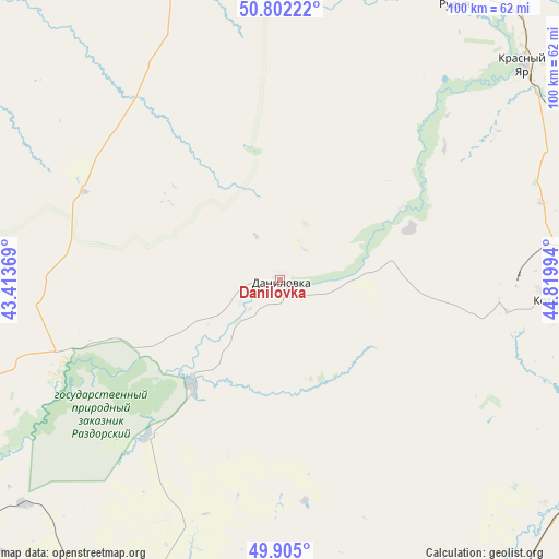
Danilovka GPS coordinates[2]
50° 21' 20.628" North, 44° 7' 0.516" East
| Map corner | latitude | longitude |
|---|---|---|
| Upper-left | 50.80222°, | 43.41369° |
| Center: | 50.35573°, | 44.11681° |
| Lower-right: | 49.905°, | 44.81994° |
| Map W x H: | 99.8×99.8 km | = 62×62mi |
| max Lat: | 73.50819° ⇑77.2% North |
| Danilovka: | 50.35573° |
| min Lat: | ⇓22.8% South 41.28413° |
| min Long | Danilovka | max Long |
| -179.12198° | 44.11681° | 179.35046° |
| W 47.5%⇐ | ⇒52.5% E |
Elevation
Elevation of Danilovka is 112 m = 367 ft, and this is 90.6 m = 297 ft below average elevation for this country.
| Max E: |
2518 m = 8261 ft | 65.7% |
| Avg. | 202.6 m = 665 ft | |
| Danilovka | 112 m = 367 ft | |
Min E: |
-28 m = -92 ft | 34.3% |
See also: Russia elevation on elevation.city.
Geographical zone
Danilovka is located in North temperate zone (between Tropic of Cancer and the Arctic Circle). Distance of this North polar circle is 1802.1 km =1119.8 mi to North.| Distance of | km | miles | from Danilovka |
|---|---|---|---|
| North Pole | 4408 | 2739 | to North |
| Arctic Circle | 1802.1 | 1119.8 | to North |
| Tropic Cancer | 2993.1 | 1859.8 | to South |
| Equator | 5599 | 3479.1 | to South |


Nearby cities:
15 places around Danilovka: (largest is in red/bold)
• Frolovo
72.6 km =45.1 mi,  206°
206°
• Kamyshin
96.7 km =60.1 mi,  107°
107°
• Kikvidze
86.6 km =53.8 mi,  299°
299°
• Kotovo
48.7 km =30.3 mi,  94°
94°
• Krasnyy Yar
57.5 km =35.7 mi,  48°
48°
• Log
98.6 km =61.3 mi,  190°
190°
• Medveditskiy
63.7 km =39.6 mi,  41°
41°
• Mikhaylovka
70.7 km =43.9 mi,  242°
242°
• Nikolayevsk
102.3 km =63.6 mi, 110°
• Petrov Val
81.2 km =50.5 mi, 106°
• Rudnya
58.3 km =36.2 mi,  32°
32°
• Samoylovka
96.5 km =60 mi,  342°
342°
• Sebrovo
64.9 km =40.3 mi, 243°
• Yelan’
71.2 km =44.2 mi, 337°
• Zhirnovsk
83.8 km =52.1 mi, 33°
Sources, notices
• [Note1] Compared only with cities in Russia existing in our database
• [Src1] Map data: © OpenStreetMap contributors (CC-BY-SA)
• [Src2] Other city data from geonames.org with taken over terms of usage.
• [Src3] Geographical zone / Annual Mean Temperature by Robert A. Rohde @ Wikipedia
