Zhirnovsk geodata
Zhirnovsk (Volgograd Oblast) is a populated place; located in Russia in Europe/Volgograd (GMT+3) time zone. With population of 17,887 people, there are 959 cities with bigger population in this country. Compared to other cities in Russia, 75% of cities are located further ↑North; 50.6% of cities are located further →East and 55.1% of cities have higher elevation than Zhirnovsk. Note1


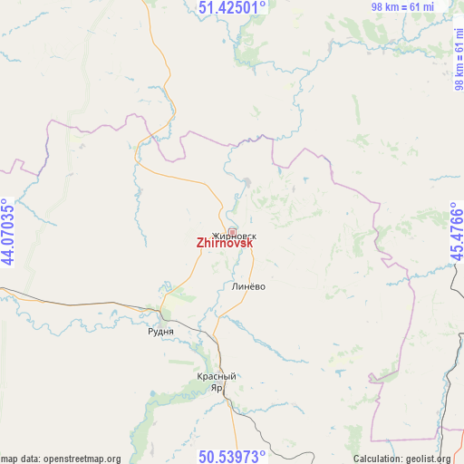
Zhirnovsk GPS coordinates[2]
50° 59' 4.128" North, 44° 46' 24.492" East
| Map corner | latitude | longitude |
|---|---|---|
| Upper-left | 51.42501°, | 44.07035° |
| Center: | 50.98448°, | 44.77347° |
| Lower-right: | 50.53973°, | 45.4766° |
| Map W x H: | 98.4×98.4 km | = 61.1×61.1mi |
| max Lat: | 73.50819° ⇑75% North |
| Zhirnovsk: | 50.98448° |
| min Lat: | ⇓25% South 41.28413° |
| min Long | Zhirnovsk | max Long |
| -179.12198° | 44.77347° | 179.35046° |
| W 49.4%⇐ | ⇒50.6% E |
Elevation
Elevation of Zhirnovsk is 134 m = 440 ft, and this is 68.6 m = 225 ft below average elevation for this country.
| Max E: |
2518 m = 8261 ft | 55.1% |
| Avg. | 202.6 m = 665 ft | |
| Zhirnovsk | 134 m = 440 ft | |
Min E: |
-28 m = -92 ft | 44.9% |
See also: Russia elevation on elevation.city.
Geographical zone
Zhirnovsk is located in North temperate zone (between Tropic of Cancer and the Arctic Circle). Distance of this North polar circle is 1732.2 km =1076.3 mi to North.| Distance of | km | miles | from Zhirnovsk |
|---|---|---|---|
| North Pole | 4338.1 | 2695.6 | to North |
| Arctic Circle | 1732.2 | 1076.3 | to North |
| Tropic Cancer | 3063 | 1903.3 | to South |
| Equator | 5668.9 | 3522.5 | to South |


Nearby cities:
15 places around Zhirnovsk: (largest is in red/bold)
• Danilovka
83.8 km =52.1 mi,  213°
213°
• Kalininsk
61 km =37.9 mi,  340°
340°
• Kamenskiy
51.3 km =31.9 mi,  102°
102°
• Kotovo
73.8 km =45.9 mi,  178°
178°
• Krasnoarmeysk
64.8 km =40.3 mi,  86°
86°
• Krasnyy Oktyabr’
89.5 km =55.6 mi,  46°
46°
• Krasnyy Yar
32.2 km =20 mi,  185°
185°
• Lysyye Gory
63.1 km =39.2 mi,  4°
4°
• Medveditskiy
22.6 km =14 mi, 190°
• Rovnoye
92.5 km =57.5 mi, 104°
• Rudnya
25.5 km =15.8 mi,  216°
216°
• Samoylovka
77.6 km =48.2 mi,  286°
286°
• Svetlyy
97 km =60.3 mi,  37°
37°
• Tatishchevo
95.3 km =59.2 mi, 36°
• Yelan’
72.6 km =45.1 mi,  266°
266°
Sources, notices
• [Note1] Compared only with cities in Russia existing in our database
• [Src1] Map data: © OpenStreetMap contributors (CC-BY-SA)
• [Src2] Other city data from geonames.org with taken over terms of usage.
• [Src3] Geographical zone / Annual Mean Temperature by Robert A. Rohde @ Wikipedia
