Kotovo geodata
Kotovo (Volgograd Oblast) is a populated place; located in Russia in Europe/Volgograd (GMT+3) time zone. With population of 26,981 people, there are 723 cities with bigger population in this country. Compared to other cities in Russia, 77.2% of cities are located further ↑North; 50.5% of cities are located further →East and 51.5% of cities have lower elevation than Kotovo. Note1


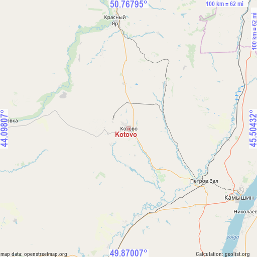
Kotovo GPS coordinates[2]
50° 19' 16.068" North, 44° 48' 4.284" East
| Map corner | latitude | longitude |
|---|---|---|
| Upper-left | 50.76795°, | 44.09807° |
| Center: | 50.32113°, | 44.80119° |
| Lower-right: | 49.87007°, | 45.50432° |
| Map W x H: | 99.8×99.8 km | = 62×62mi |
| max Lat: | 73.50819° ⇑77.2% North |
| Kotovo: | 50.32113° |
| min Lat: | ⇓22.8% South 41.28413° |
| min Long | Kotovo | max Long |
| -179.12198° | 44.80119° | 179.35046° |
| W 49.5%⇐ | ⇒50.5% E |
Elevation
Elevation of Kotovo is 148 m = 486 ft, and this is 54.6 m = 179 ft below average elevation for this country.
| Max E: |
2518 m = 8261 ft | 48.5% |
| Avg. | 202.6 m = 665 ft | |
| Kotovo | 148 m = 486 ft | |
Min E: |
-28 m = -92 ft | 51.5% |
See also: Russia elevation on elevation.city.
Geographical zone
Kotovo is located in North temperate zone (between Tropic of Cancer and the Arctic Circle). Distance of this North polar circle is 1806 km =1122.2 mi to North.| Distance of | km | miles | from Kotovo |
|---|---|---|---|
| North Pole | 4411.9 | 2741.4 | to North |
| Arctic Circle | 1806 | 1122.2 | to North |
| Tropic Cancer | 2989.3 | 1857.5 | to South |
| Equator | 5595.2 | 3476.7 | to South |


Nearby cities:
15 places around Kotovo: (largest is in red/bold)
• Antipovka
65.7 km =40.8 mi,  146°
146°
• Bykovo
74.6 km =46.4 mi, 145°
• Danilovka
48.7 km =30.3 mi,  274°
274°
• Frolovo
101.7 km =63.2 mi,  233°
233°
• Gornyy Balykley
87.8 km =54.6 mi,  167°
167°
• Kamenskiy
79.3 km =49.3 mi,  37°
37°
• Kamyshin
50.3 km =31.3 mi,  119°
119°
• Krasnoarmeysk
100.4 km =62.4 mi, 38°
• Krasnyy Yar
42.1 km =26.2 mi,  352°
352°
• Medveditskiy
52 km =32.3 mi, 353°
• Nikolayevsk
57.1 km =35.5 mi, 124°
• Petrov Val
35.1 km =21.8 mi, 124°
• Rovnoye
101.8 km =63.3 mi,  60°
60°
• Rudnya
55.8 km =34.7 mi,  342°
342°
• Zhirnovsk
73.8 km =45.9 mi,  358°
358°
Sources, notices
• [Note1] Compared only with cities in Russia existing in our database
• [Src1] Map data: © OpenStreetMap contributors (CC-BY-SA)
• [Src2] Other city data from geonames.org with taken over terms of usage.
• [Src3] Geographical zone / Annual Mean Temperature by Robert A. Rohde @ Wikipedia
