Cherëmushki geodata
Cherëmushki (Moscow) is a seat of a third-order administrative division; located in Russia in Europe/Moscow (GMT+3) time zone. With population of 106,587 people, there are 192 cities with bigger population in this country. Compared to other cities in Russia, 60.9% of cities are located further ↓South; 81% of cities are located further →East and 67.7% of cities have lower elevation than Cherëmushki. Note1
Administrative division(s):
- Level 1: Moscow
- Level 2: Yugo-Zapadnyy Administrativnyy Okrug
- Level 3: Cheryomushki District


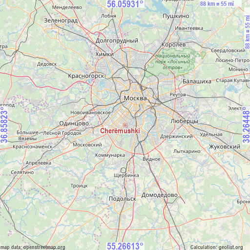
Cherëmushki GPS coordinates[2]
55° 39' 53.028" North, 37° 33' 40.86" East
| Map corner | latitude | longitude |
|---|---|---|
| Upper-left | 56.05931°, | 36.85823° |
| Center: | 55.66473°, | 37.56135° |
| Lower-right: | 55.26613°, | 38.26448° |
| Map W x H: | 88.2×88.2 km | = 54.8×54.8mi |
| max Lat: | 73.50819° ⇑39.1% North |
| Cherëmushki: | 55.66473° |
| min Lat: | ⇓60.9% South 41.28413° |
| min Long | Cherëmushki | max Long |
| -179.12198° | 37.56135° | 179.35046° |
| W 19%⇐ | ⇒81% E |
Elevation
Elevation of Cherëmushki is 190 m = 623 ft, and this is 12.6 m = 41 ft below average elevation for this country.
| Max E: |
2518 m = 8261 ft | 32.3% |
| Avg. | 202.6 m = 665 ft | |
| Cherëmushki | 190 m = 623 ft | |
Min E: |
-28 m = -92 ft | 67.7% |
See also: Cherëmushki elevation on elevation.city.
Geographical zone
Cherëmushki is located in North temperate zone (between Tropic of Cancer and the Arctic Circle). Distance of this North polar circle is 1211.8 km =753 mi to North.| Distance of | km | miles | from Cherëmushki |
|---|---|---|---|
| North Pole | 3817.7 | 2372.2 | to North |
| Arctic Circle | 1211.8 | 753 | to North |
| Tropic Cancer | 3583.4 | 2226.6 | to South |
| Equator | 6189.3 | 3845.9 | to South |


Nearby cities:
15 places around Cherëmushki: (largest is in red/bold)
• Kastanayevo
6.9 km =4.3 mi,  326°
326°
• Kotlovka
2.7 km =1.7 mi,  102°
102°
• Leninskiye Gory
3.9 km =2.4 mi,  4°
4°
• Luzhniki
5.7 km =3.5 mi,  355°
355°
• Nagornyy
3.8 km =2.4 mi,  115°
115°
• Nikol’skoye
5.3 km =3.3 mi,  292°
292°
• Nikulino
6 km =3.7 mi,  274°
274°
• Novyye Cherëmushki
4.2 km =2.6 mi,  19°
19°
• Ramenki
5.5 km =3.4 mi,  315°
315°
• Semënovskoye
2.2 km =1.4 mi,  341°
341°
• Troparëvo
4.9 km =3 mi,  258°
258°
• Tyoply Stan
6.5 km =4 mi,  220°
220°
• Vorob’yovo
6 km =3.7 mi, 343°
• Yasenevo
6.9 km =4.3 mi,  202°
202°
• Zyuzino
1.1 km =0.7 mi,  155°
155°
Sources, notices
• [Note1] Compared only with cities in Russia existing in our database
• [Src1] Map data: © OpenStreetMap contributors (CC-BY-SA)
• [Src2] Other city data from geonames.org with taken over terms of usage.
• [Src3] Geographical zone / Annual Mean Temperature by Robert A. Rohde @ Wikipedia
