Bezhta geodata
Bezhta (Dagestan) is a populated place; located in Russia in Europe/Moscow (GMT+3) time zone. With population of 3,994 people, there are 3122 cities with bigger population in this country. Compared to other cities in Russia, 99.4% of cities are located further ↑North; 53.2% of cities are located further ←West and 99.6% of cities have lower elevation than Bezhta. Note1


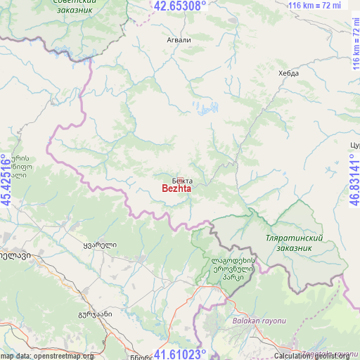
Bezhta GPS coordinates[2]
42° 8' 1.68" North, 46° 7' 41.808" East
| Map corner | latitude | longitude |
|---|---|---|
| Upper-left | 42.65308°, | 45.42516° |
| Center: | 42.1338°, | 46.12828° |
| Lower-right: | 41.61023°, | 46.83141° |
| Map W x H: | 116×116 km | = 72.1×72.1mi |
| max Lat: | 73.50819° ⇑99.4% North |
| Bezhta: | 42.1338° |
| min Lat: | ⇓0.6% South 41.28413° |
| min Long | Bezhta | max Long |
| -179.12198° | 46.12828° | 179.35046° |
| W 53.2%⇐ | ⇒46.8% E |
Elevation
Elevation of Bezhta is 1624 m = 5328 ft, and this is 1421.4 m = 4663 ft above average elevation for this country.
| Max E: |
2518 m = 8261 ft | 0.40000000000001% |
| Bezhta | 1624 m 5328 ft | |
| Avg. | 202.6 m = 665 ft | |
Min E: |
-28 m = -92 ft | 99.6% |
See also: Russia elevation on elevation.city.
Geographical zone
Bezhta is located in North temperate zone (between Tropic of Cancer and the Arctic Circle). Distance of this Northern Tropic circle is 2078.9 km =1291.8 mi to South.| Distance of | km | miles | from Bezhta |
|---|---|---|---|
| North Pole | 5322.2 | 3307.1 | to North |
| Arctic Circle | 2716.3 | 1687.8 | to North |
| Tropic Cancer | 2078.9 | 1291.8 | to South |
| Equator | 4684.8 | 2911 | to South |


Nearby cities:
15 places around Bezhta: (largest is in red/bold)
• Agvali
45 km =28 mi,  359°
359°
• Aknada
30 km =18.6 mi,  6°
6°
• Andi
73.1 km =45.4 mi, 8°
• Ansalta
61.8 km =38.4 mi, 359°
• Gagatli
75.4 km =46.9 mi, 10°
• Gunib
74.4 km =46.2 mi,  67°
67°
• Itum-Kali
80.8 km =50.2 mi,  325°
325°
• Karata
54.1 km =33.6 mi,  18°
18°
• Khebda
49 km =30.4 mi,  45°
45°
• Khunzakh
65.8 km =40.9 mi, 46°
• Kidero
15.7 km =9.8 mi,  295°
295°
• Kumukh
81.5 km =50.6 mi,  87°
87°
• Siukh
62.1 km =38.6 mi,  33°
33°
• Tlyarata
19.1 km =11.9 mi,  99°
99°
• Tsurib
59 km =36.7 mi,  78°
78°
Sources, notices
• [Note1] Compared only with cities in Russia existing in our database
• [Src1] Map data: © OpenStreetMap contributors (CC-BY-SA)
• [Src2] Other city data from geonames.org with taken over terms of usage.
• [Src3] Geographical zone / Annual Mean Temperature by Robert A. Rohde @ Wikipedia
