Tlyarata geodata
Tlyarata (Dagestan) is a populated place; located in Russia in Europe/Moscow (GMT+3) time zone. With population of 1,898 people, there are 4222 cities with bigger population in this country. Compared to other cities in Russia, 99.5% of cities are located further ↑North; 53.7% of cities are located further ←West and 99.4% of cities have lower elevation than Tlyarata. Note1


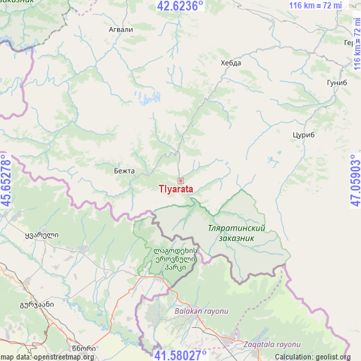
Tlyarata GPS coordinates[2]
42° 6' 14.688" North, 46° 21' 21.24" East
| Map corner | latitude | longitude |
|---|---|---|
| Upper-left | 42.6236°, | 45.65278° |
| Center: | 42.10408°, | 46.3559° |
| Lower-right: | 41.58027°, | 47.05903° |
| Map W x H: | 116×116 km | = 72.1×72.1mi |
| max Lat: | 73.50819° ⇑99.5% North |
| Tlyarata: | 42.10408° |
| min Lat: | ⇓0.5% South 41.28413° |
| min Long | Tlyarata | max Long |
| -179.12198° | 46.3559° | 179.35046° |
| W 53.7%⇐ | ⇒46.3% E |
Elevation
Elevation of Tlyarata is 1428 m = 4685 ft, and this is 1225.4 m = 4020 ft above average elevation for this country.
| Max E: |
2518 m = 8261 ft | 0.59999999999999% |
| Tlyarata | 1428 m 4685 ft | |
| Avg. | 202.6 m = 665 ft | |
Min E: |
-28 m = -92 ft | 99.4% |
See also: Russia elevation on elevation.city.
Geographical zone
Tlyarata is located in North temperate zone (between Tropic of Cancer and the Arctic Circle). Distance of this Northern Tropic circle is 2075.6 km =1289.7 mi to South.| Distance of | km | miles | from Tlyarata |
|---|---|---|---|
| North Pole | 5325.5 | 3309.1 | to North |
| Arctic Circle | 2719.6 | 1689.9 | to North |
| Tropic Cancer | 2075.6 | 1289.7 | to South |
| Equator | 4681.5 | 2908.9 | to South |


Nearby cities:
15 places around Tlyarata: (largest is in red/bold)
• Agvali
52.1 km =32.4 mi,  338°
338°
• Aknada
36.4 km =22.6 mi, 335°
• Ansalta
68 km =42.3 mi, 343°
• Bezhta
19.1 km =11.9 mi,  279°
279°
• Gergebil’
73.5 km =45.7 mi,  52°
52°
• Gunib
59.2 km =36.8 mi,  57°
57°
• Karata
54.6 km =33.9 mi,  358°
358°
• Khebda
41.1 km =25.5 mi,  23°
23°
• Khunzakh
56.6 km =35.2 mi,  30°
30°
• Kidero
34.5 km =21.4 mi,  286°
286°
• Kuli
73.9 km =45.9 mi,  97°
97°
• Kumukh
63.1 km =39.2 mi,  83°
83°
• Siukh
57.3 km =35.6 mi, 15°
• Tsurib
41.8 km =26 mi,  69°
69°
• Vachi
70.9 km =44.1 mi,  92°
92°
Sources, notices
• [Note1] Compared only with cities in Russia existing in our database
• [Src1] Map data: © OpenStreetMap contributors (CC-BY-SA)
• [Src2] Other city data from geonames.org with taken over terms of usage.
• [Src3] Geographical zone / Annual Mean Temperature by Robert A. Rohde @ Wikipedia
