Obsharovka geodata
Obsharovka (Samara Oblast) is a populated place; located in Russia in Europe/Samara (GMT+4) time zone. With population of 5,668 people, there are 2375 cities with bigger population in this country. Compared to other cities in Russia, 62.1% of cities are located further ↑North; 60.6% of cities are located further ←West and 85.1% of cities have higher elevation than Obsharovka. Note1


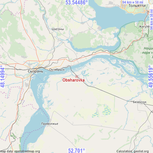
Obsharovka GPS coordinates[2]
53° 7' 30" North, 48° 51' 11.016" East
| Map corner | latitude | longitude |
|---|---|---|
| Upper-left | 53.54486°, | 48.14994° |
| Center: | 53.125°, | 48.85306° |
| Lower-right: | 52.701°, | 49.55619° |
| Map W x H: | 93.8×93.8 km | = 58.3×58.3mi |
| max Lat: | 73.50819° ⇑62.1% North |
| Obsharovka: | 53.125° |
| min Lat: | ⇓37.9% South 41.28413° |
| min Long | Obsharovka | max Long |
| -179.12198° | 48.85306° | 179.35046° |
| W 60.6%⇐ | ⇒39.4% E |
Elevation
Elevation of Obsharovka is 47 m = 154 ft, and this is 155.6 m = 510 ft below average elevation for this country.
| Max E: |
2518 m = 8261 ft | 85.1% |
| Avg. | 202.6 m = 665 ft | |
| Obsharovka | 47 m = 154 ft | |
Min E: |
-28 m = -92 ft | 14.9% |
See also: Russia elevation on elevation.city.
Geographical zone
Obsharovka is located in North temperate zone (between Tropic of Cancer and the Arctic Circle). Distance of this North polar circle is 1494.2 km =928.5 mi to North.| Distance of | km | miles | from Obsharovka |
|---|---|---|---|
| North Pole | 4100.1 | 2547.7 | to North |
| Arctic Circle | 1494.2 | 928.5 | to North |
| Tropic Cancer | 3301 | 2051.1 | to South |
| Equator | 5906.9 | 3670.4 | to South |


Nearby cities:
15 places around Obsharovka: (largest is in red/bold)
• Balasheyka
54.1 km =33.6 mi,  289°
289°
• Bezenchuk
41.9 km =26 mi,  112°
112°
• Bol’shaya Ryazan’
33.4 km =20.8 mi,  63°
63°
• Mezhdurechensk
23.3 km =14.5 mi,  47°
47°
• Oktyabr’sk
11.2 km =7 mi, 294°
• Osinki
54.2 km =33.7 mi,  125°
125°
• Perevoloki
25.6 km =15.9 mi, 58°
• Podstepki
47.3 km =29.4 mi,  23°
23°
• Shigony
31.4 km =19.5 mi,  338°
338°
• Syzran’
25.9 km =16.1 mi,  278°
278°
• Tol’yatti
55.7 km =34.6 mi,  35°
35°
• Valy
43 km =26.7 mi, 58°
• Varlamovo
29.6 km =18.4 mi, 284°
• Zhigulevsk
52.5 km =32.6 mi, 54°
• Zhiguli
39.5 km =24.5 mi, 49°
Sources, notices
• [Note1] Compared only with cities in Russia existing in our database
• [Src1] Map data: © OpenStreetMap contributors (CC-BY-SA)
• [Src2] Other city data from geonames.org with taken over terms of usage.
• [Src3] Geographical zone / Annual Mean Temperature by Robert A. Rohde @ Wikipedia
