Dvubratskiy geodata
Dvubratskiy (Krasnodarskiy) is a populated place; located in Russia in Europe/Moscow (GMT+3) time zone. With population of 10,272 people, there are 1469 cities with bigger population in this country. Compared to other cities in Russia, 86.3% of cities are located further ↑North; 68.5% of cities are located further →East and 70.6% of cities have higher elevation than Dvubratskiy. Note1


Dvubratskiy GPS coordinates[2]
45° 14' 19.968" North, 39° 48' 17.964" East
| Map corner | latitude | longitude |
|---|---|---|
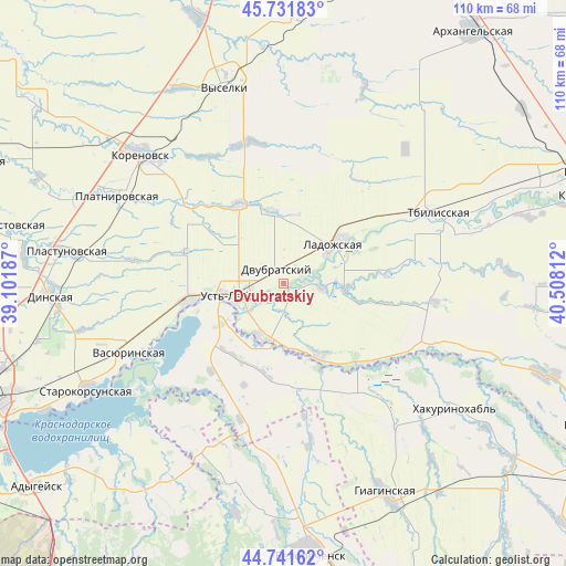
| Upper-left | 45.73183°, | 39.10187° |
| Center: | 45.23888°, | 39.80499° |
| Lower-right: | 44.74162°, | 40.50812° |
| Map W x H: | 110.1×110.1 km | = 68.4×68.4mi |
| max Lat: | 73.50819° ⇑86.3% North |
| Dvubratskiy: | 45.23888° |
| min Lat: | ⇓13.7% South 41.28413° |
| min Long | Dvubratskiy | max Long |
| -179.12198° | 39.80499° | 179.35046° |
| W 31.5%⇐ | ⇒68.5% E |
Elevation
Elevation of Dvubratskiy is 101 m = 331 ft, and this is 101.6 m = 333 ft below average elevation for this country.
| Max E: |
2518 m = 8261 ft | 70.6% |
| Avg. | 202.6 m = 665 ft | |
| Dvubratskiy | 101 m = 331 ft | |
Min E: |
-28 m = -92 ft | 29.4% |
See also: Russia elevation on elevation.city.
Geographical zone
Dvubratskiy is located in North temperate zone (between Tropic of Cancer and the Arctic Circle). Distance of this North polar circle is 2371.1 km =1473.3 mi to North.| Distance of | km | miles | from Dvubratskiy |
|---|---|---|---|
| North Pole | 4977 | 3092.6 | to North |
| Arctic Circle | 2371.1 | 1473.3 | to North |
| Tropic Cancer | 2424.2 | 1506.3 | to South |
| Equator | 5030.1 | 3125.6 | to South |


Nearby cities:
15 places around Dvubratskiy: (largest is in red/bold)
• Beloye
24.4 km =15.2 mi,  209°
209°
• Khatukay
12.3 km =7.6 mi,  244°
244°
• Korenovsk
37.7 km =23.4 mi,  312°
312°
• Krasnogvardeyskoye
22 km =13.7 mi, 235°
• Ladozhskaya
13 km =8.1 mi,  53°
53°
• Nekrasovskaya
11.4 km =7.1 mi,  202°
202°
• Novobeysugskaya
26.7 km =16.6 mi,  13°
13°
• Novolabinskaya
16 km =9.9 mi,  154°
154°
• Platnirovskaya
37.2 km =23.1 mi,  297°
297°
• Ryazanskaya
35.8 km =22.2 mi, 208°
• Tbilisskaya
33.1 km =20.6 mi,  65°
65°
• Ust’-Labinsk
9.6 km =6 mi,  250°
250°
• Vasyurinskaya
32.7 km =20.3 mi, 245°
• Velikovechnoye
34.1 km =21.2 mi,  186°
186°
• Vyselki
39.6 km =24.6 mi,  343°
343°
Sources, notices
• [Note1] Compared only with cities in Russia existing in our database
• [Src1] Map data: © OpenStreetMap contributors (CC-BY-SA)
• [Src2] Other city data from geonames.org with taken over terms of usage.
• [Src3] Geographical zone / Annual Mean Temperature by Robert A. Rohde @ Wikipedia
