Platnirovskaya geodata
Platnirovskaya (Krasnodarskiy) is a populated place; located in Russia in Europe/Moscow (GMT+3) time zone. With population of 11,710 people, there are 1305 cities with bigger population in this country. Compared to other cities in Russia, 85.6% of cities are located further ↑North; 70.6% of cities are located further →East and 88.5% of cities have higher elevation than Platnirovskaya. Note1


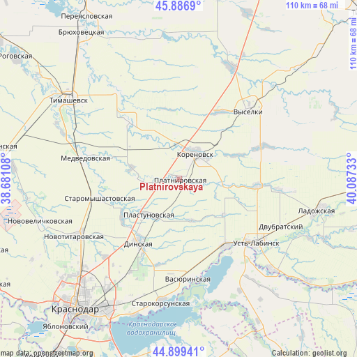
Platnirovskaya GPS coordinates[2]
45° 23' 43.116" North, 39° 23' 3.12" East
| Map corner | latitude | longitude |
|---|---|---|
| Upper-left | 45.8869°, | 38.68108° |
| Center: | 45.39531°, | 39.3842° |
| Lower-right: | 44.89941°, | 40.08733° |
| Map W x H: | 109.8×109.8 km | = 68.2×68.2mi |
| max Lat: | 73.50819° ⇑85.6% North |
| Platnirovskaya: | 45.39531° |
| min Lat: | ⇓14.4% South 41.28413° |
| min Long | Platnirovskaya | max Long |
| -179.12198° | 39.3842° | 179.35046° |
| W 29.4%⇐ | ⇒70.6% E |
Elevation
Elevation of Platnirovskaya is 34 m = 112 ft, and this is 168.6 m = 553 ft below average elevation for this country.
| Max E: |
2518 m = 8261 ft | 88.5% |
| Avg. | 202.6 m = 665 ft | |
| Platnirovskaya | 34 m = 112 ft | |
Min E: |
-28 m = -92 ft | 11.5% |
See also: Russia elevation on elevation.city.
Geographical zone
Platnirovskaya is located in North temperate zone (between Tropic of Cancer and the Arctic Circle). Distance of this North polar circle is 2353.7 km =1462.5 mi to North.| Distance of | km | miles | from Platnirovskaya |
|---|---|---|---|
| North Pole | 4959.6 | 3081.8 | to North |
| Arctic Circle | 2353.7 | 1462.5 | to North |
| Tropic Cancer | 2441.6 | 1517.1 | to South |
| Equator | 5047.5 | 3136.4 | to South |


Nearby cities:
15 places around Platnirovskaya: (largest is in red/bold)
• Agronom
32 km =19.9 mi,  207°
207°
• Dinskaya
23.5 km =14.6 mi, 211°
• Dvubratskiy
37.2 km =23.1 mi,  117°
117°
• Khatukay
31.5 km =19.6 mi,  136°
136°
• Korenovsk
9.7 km =6 mi,  32°
32°
• Krasnogvardeyskoye
33.2 km =20.6 mi,  153°
153°
• Medvedovskaya
28.7 km =17.8 mi,  282°
282°
• Novokorsunskaya
33 km =20.5 mi,  325°
325°
• Novotitarovskaya
36.1 km =22.4 mi,  240°
240°
• Plastunovskaya
14.6 km =9.1 mi,  219°
219°
• Starokorsunskaya
38 km =23.6 mi,  188°
188°
• Staromyshastovskaya
24.8 km =15.4 mi,  256°
256°
• Ust’-Labinsk
31.5 km =19.6 mi,  130°
130°
• Vasyurinskaya
31 km =19.3 mi,  174°
174°
• Vyselki
30.1 km =18.7 mi,  46°
46°
Sources, notices
• [Note1] Compared only with cities in Russia existing in our database
• [Src1] Map data: © OpenStreetMap contributors (CC-BY-SA)
• [Src2] Other city data from geonames.org with taken over terms of usage.
• [Src3] Geographical zone / Annual Mean Temperature by Robert A. Rohde @ Wikipedia
