Krasnyy Kommunar geodata
Krasnyy Kommunar (Orenburg Oblast) is a populated place; located in Russia in Asia/Yekaterinburg (GMT+5) time zone. With population of 4,167 people, there are 3022 cities with bigger population in this country. Compared to other cities in Russia, 69.4% of cities are located further ↑North; 66.8% of cities are located further ←West and 68.8% of cities have higher elevation than Krasnyy Kommunar. Note1


Krasnyy Kommunar GPS coordinates[2]
51° 57' 51.696" North, 55° 22' 0.48" East
| Map corner | latitude | longitude |
|---|---|---|
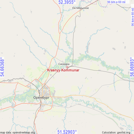
| Upper-left | 52.3955°, | 54.66368° |
| Center: | 51.96436°, | 55.3668° |
| Lower-right: | 51.52903°, | 56.06993° |
| Map W x H: | 96.3×96.3 km | = 59.8×59.8mi |
| max Lat: | 73.50819° ⇑69.4% North |
| Krasnyy Kommunar: | 51.96436° |
| min Lat: | ⇓30.6% South 41.28413° |
| min Long | Krasnyy Kommuna | max Long |
| -179.12198° | 55.3668° | 179.35046° |
| W 66.8%⇐ | ⇒33.2% E |
Elevation
Elevation of Krasnyy Kommunar is 105 m = 344 ft, and this is 97.6 m = 320 ft below average elevation for this country.
| Max E: |
2518 m = 8261 ft | 68.8% |
| Avg. | 202.6 m = 665 ft | |
| Krasnyy Kommunar | 105 m = 344 ft | |
Min E: |
-28 m = -92 ft | 31.2% |
See also: Russia elevation on elevation.city.
Geographical zone
Krasnyy Kommunar is located in North temperate zone (between Tropic of Cancer and the Arctic Circle). Distance of this North polar circle is 1623.3 km =1008.7 mi to North.| Distance of | km | miles | from Krasnyy Kommunar |
|---|---|---|---|
| North Pole | 4229.2 | 2627.9 | to North |
| Arctic Circle | 1623.3 | 1008.7 | to North |
| Tropic Cancer | 3172 | 1971 | to South |
| Equator | 5777.9 | 3590.2 | to South |


Nearby cities:
15 places around Krasnyy Kommunar: (largest is in red/bold)
• Isyangulovo
86.5 km =53.7 mi,  73°
73°
• Krasnokholm
92.7 km =57.6 mi,  243°
243°
• Matveyevka
59.5 km =37 mi, 69°
• Mayachnyy
82.9 km =51.5 mi,  15°
15°
• Nezhinka
21.9 km =13.6 mi,  179°
179°
• Nizhnepavlovka
47.8 km =29.7 mi,  234°
234°
• Orenburg
28.2 km =17.5 mi,  220°
220°
• Perevolotskiy
81 km =50.3 mi,  263°
263°
• Podgorodnyaya Pokrovka
30.1 km =18.7 mi, 239°
• Prigorodnyy
23.1 km =14.4 mi,  197°
197°
• Sakmara
3.2 km =2 mi,  314°
314°
• Saraktash
71 km =44.1 mi,  106°
106°
• Tatarskaya Kargala
13.4 km =8.3 mi, 262°
• Tyul’gan
68.7 km =42.7 mi,  52°
52°
• Yermolayevo
88.7 km =55.1 mi, 19°
Sources, notices
• [Note1] Compared only with cities in Russia existing in our database
• [Src1] Map data: © OpenStreetMap contributors (CC-BY-SA)
• [Src2] Other city data from geonames.org with taken over terms of usage.
• [Src3] Geographical zone / Annual Mean Temperature by Robert A. Rohde @ Wikipedia
