Raduzhnyy geodata
Raduzhnyy (Kirov) is a populated place; located in Russia in Europe/Moscow (GMT+3) time zone. With population of 9,514 people, there are 1589 cities with bigger population in this country. Compared to other cities in Russia, 87.8% of cities are located further ↓South; 61.5% of cities are located further ←West and 65% of cities have lower elevation than Raduzhnyy. Note1


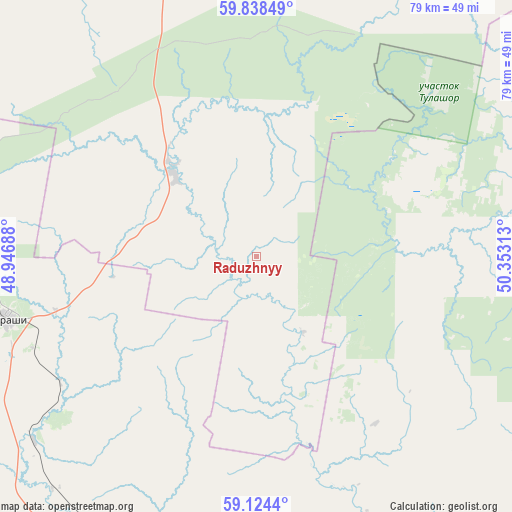
Raduzhnyy GPS coordinates[2]
59° 28' 59.988" North, 49° 39' 0" East
| Map corner | latitude | longitude |
|---|---|---|
| Upper-left | 59.83849°, | 48.94688° |
| Center: | 59.48333°, | 49.65° |
| Lower-right: | 59.1244°, | 50.35313° |
| Map W x H: | 79.4×79.4 km | = 49.3×49.3mi |
| max Lat: | 73.50819° ⇑12.2% North |
| Raduzhnyy: | 59.48333° |
| min Lat: | ⇓87.8% South 41.28413° |
| min Long | Raduzhnyy | max Long |
| -179.12198° | 49.65° | 179.35046° |
| W 61.5%⇐ | ⇒38.5% E |
Elevation
Elevation of Raduzhnyy is 182 m = 597 ft, and this is 20.6 m = 68 ft below average elevation for this country.
| Max E: |
2518 m = 8261 ft | 35% |
| Avg. | 202.6 m = 665 ft | |
| Raduzhnyy | 182 m = 597 ft | |
Min E: |
-28 m = -92 ft | 65% |
See also: Russia elevation on elevation.city.
Geographical zone
Raduzhnyy is located in North temperate zone (between Tropic of Cancer and the Arctic Circle). Distance of this North polar circle is 787.2 km =489.1 mi to North.| Distance of | km | miles | from Raduzhnyy |
|---|---|---|---|
| North Pole | 3393.1 | 2108.4 | to North |
| Arctic Circle | 787.2 | 489.1 | to North |
| Tropic Cancer | 4008 | 2490.5 | to South |
| Equator | 6613.9 | 4109.7 | to South |


Nearby cities:
15 places around Raduzhnyy: (largest is in red/bold)
• Belaya Kholunitsa
99.1 km =61.6 mi,  136°
136°
• Dubrovka
89.9 km =55.9 mi,  108°
108°
• Karintorf
107.8 km =67 mi,  163°
163°
• Kirov
98.6 km =61.3 mi,  179°
179°
• Kirovo-Chepetsk
105.7 km =65.7 mi,  167°
167°
• Letka
18.3 km =11.4 mi,  315°
315°
• Lyangasovo
108 km =67.1 mi,  186°
186°
• Maromitsa
101.4 km =63 mi,  294°
294°
• Murashi
40 km =24.9 mi,  256°
256°
• Murygino
83.6 km =51.9 mi, 187°
• Nagorsk
68.1 km =42.3 mi, 105°
• Oparino
87.2 km =54.2 mi,  298°
298°
• Slobodskoy
88.8 km =55.2 mi, 160°
• Stulovo
89.2 km =55.4 mi, 161°
• Vakhrushi
91.4 km =56.8 mi, 166°
Sources, notices
• [Note1] Compared only with cities in Russia existing in our database
• [Src1] Map data: © OpenStreetMap contributors (CC-BY-SA)
• [Src2] Other city data from geonames.org with taken over terms of usage.
• [Src3] Geographical zone / Annual Mean Temperature by Robert A. Rohde @ Wikipedia
